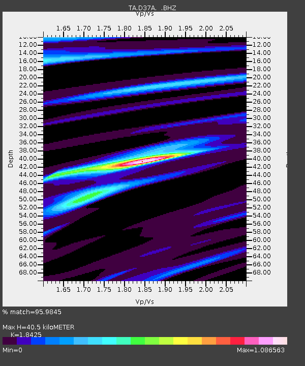
D37A Cotton, MN, USA - Earthquake Result Viewer
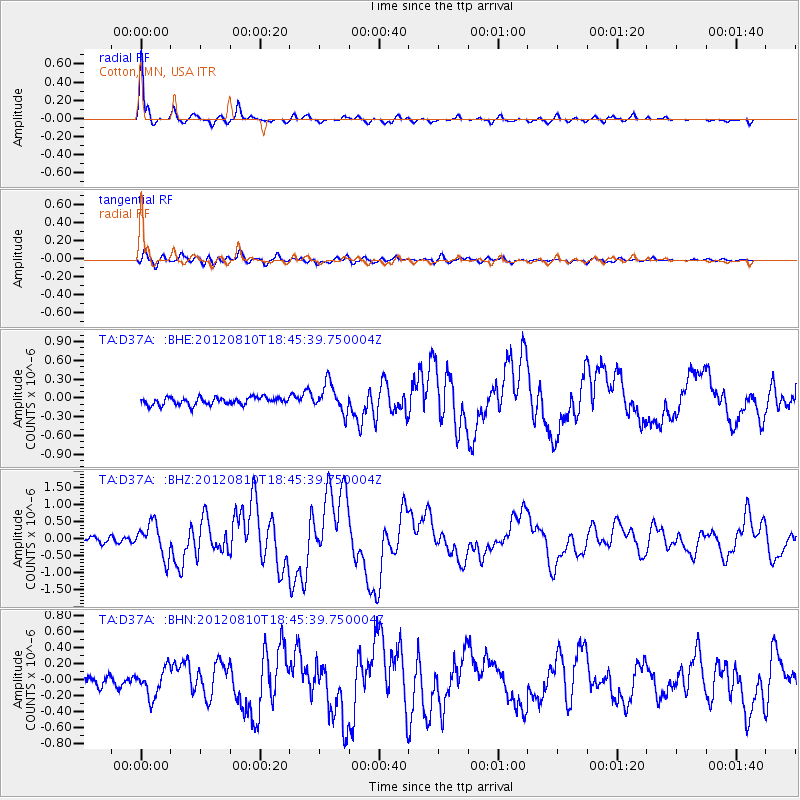
Earthquake location: Fox Islands, Aleutian Islands
Earthquake latitude/longitude: 52.6/-167.4
Earthquake time(UTC): 2012/08/10 (223) 18:37:43 GMT
Earthquake Depth: 13 km
Earthquake Magnitude: 5.9 MB, 6.2 MS, 6.2 MW, 6.2 MW
Earthquake Catalog/Contributor: WHDF/NEIC
Network: TA USArray Transportable Network (new EarthScope stations)
Station: D37A Cotton, MN, USA
Lat/Lon: 47.16 N/92.43 W
Elevation: 413 m
Distance: 46.6 deg
Az: 65.139 deg
Baz: 305.87 deg
Ray Param: 0.07054086
Estimated Moho Depth: 40.5 km
Estimated Crust Vp/Vs: 1.84
Assumed Crust Vp: 6.571 km/s
Estimated Crust Vs: 3.566 km/s
Estimated Crust Poisson's Ratio: 0.29
Radial Match: 95.9845 %
Radial Bump: 303
Transverse Match: 81.53113 %
Transverse Bump: 400
SOD ConfigId: 469095
Insert Time: 2013-02-22 05:51:36.496 +0000
GWidth: 2.5
Max Bumps: 400
Tol: 0.001

Signal To Noise

ChannelStoNSTALTA
TA:D37A: :BHZ:20120810T18:45:39.750004Z6.8079774.866828E-77.1487136E-8
TA:D37A: :BHN:20120810T18:45:39.750004Z2.49038241.7160744E-76.890807E-8
TA:D37A: :BHE:20120810T18:45:39.750004Z3.88009882.2643218E-75.8357323E-8
Arrivals
Ps5.5 SECOND
PpPs16 SECOND
PsPs/PpSs22 SECOND