TAM Tamanrasset, Algeria - Earthquake Result Viewer
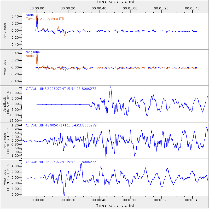
Earthquake location: Nicobar Islands, India Region
Earthquake latitude/longitude: 7.9/92.2
Earthquake time(UTC): 2005/07/24 (205) 15:42:06 GMT
Earthquake Depth: 16 km
Earthquake Magnitude: 6.6 MB, 7.5 MS, 7.3 MW, 7.2 MW
Earthquake Catalog/Contributor: WHDF/NEIC
Network: G GEOSCOPE
Station: TAM Tamanrasset, Algeria
Lat/Lon: 22.79 N/5.53 E
Elevation: 1377 m
Distance: 83.9 deg
Az: 292.105 deg
Baz: 83.99 deg
Ray Param: 0.045834877
Estimated Moho Depth: 34.5 km
Estimated Crust Vp/Vs: 1.81
Assumed Crust Vp: 6.61 km/s
Estimated Crust Vs: 3.647 km/s
Estimated Crust Poisson's Ratio: 0.28
Radial Match: 98.75101 %
Radial Bump: 268
Transverse Match: 94.50195 %
Transverse Bump: 400
SOD ConfigId: 2564
Insert Time: 2010-02-27 00:34:37.462 +0000
GWidth: 2.5
Max Bumps: 400
Tol: 0.001

Signal To Noise

ChannelStoNSTALTA
G:TAM: :BHN:20050724T15:54:03.800027Z0.812629945.0679137E-86.236435E-8
G:TAM: :BHE:20050724T15:54:03.800027Z4.70522932.4357706E-75.1767316E-8
G:TAM: :BHZ:20050724T15:54:03.800027Z15.39145857.619758E-74.9506408E-8
Arrivals
Ps4.4 SECOND
PpPs14 SECOND
PsPs/PpSs19 SECOND