Y46A Houston, MS, USA - Earthquake Result Viewer
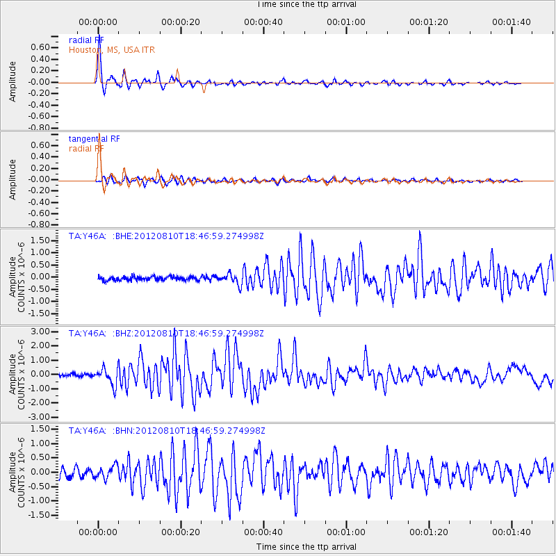
Earthquake location: Fox Islands, Aleutian Islands
Earthquake latitude/longitude: 52.6/-167.4
Earthquake time(UTC): 2012/08/10 (223) 18:37:43 GMT
Earthquake Depth: 13 km
Earthquake Magnitude: 5.9 MB, 6.2 MS, 6.2 MW, 6.2 MW
Earthquake Catalog/Contributor: WHDF/NEIC
Network: TA USArray Transportable Network (new EarthScope stations)
Station: Y46A Houston, MS, USA
Lat/Lon: 33.88 N/88.86 W
Elevation: 109 m
Distance: 57.3 deg
Az: 75.726 deg
Baz: 314.763 deg
Ray Param: 0.063581795
Estimated Moho Depth: 59.75 km
Estimated Crust Vp/Vs: 1.63
Assumed Crust Vp: 6.201 km/s
Estimated Crust Vs: 3.81 km/s
Estimated Crust Poisson's Ratio: 0.20
Radial Match: 96.81389 %
Radial Bump: 284
Transverse Match: 85.01883 %
Transverse Bump: 400
SOD ConfigId: 469095
Insert Time: 2013-02-22 05:58:13.753 +0000
GWidth: 2.5
Max Bumps: 400
Tol: 0.001

Signal To Noise

ChannelStoNSTALTA
TA:Y46A: :BHZ:20120810T18:46:59.274998Z7.3148876.0521353E-78.273723E-8
TA:Y46A: :BHN:20120810T18:46:59.274998Z1.67531292.2432425E-71.3389992E-7
TA:Y46A: :BHE:20120810T18:46:59.274998Z2.9181072.2436387E-77.6886785E-8
Arrivals
Ps6.4 SECOND
PpPs24 SECOND
PsPs/PpSs30 SECOND