Z48A Northport, AL, USA - Earthquake Result Viewer
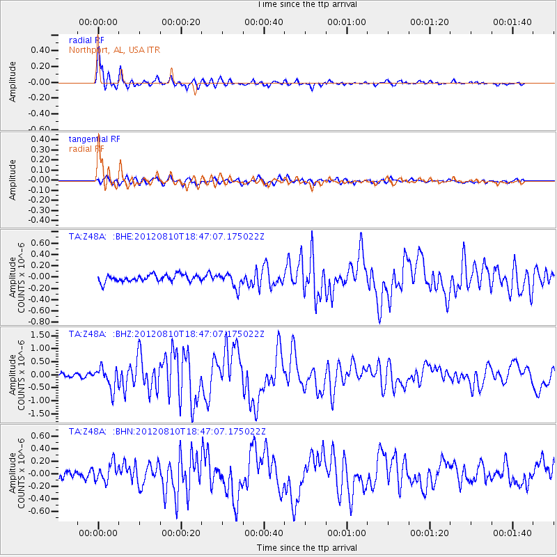
Earthquake location: Fox Islands, Aleutian Islands
Earthquake latitude/longitude: 52.6/-167.4
Earthquake time(UTC): 2012/08/10 (223) 18:37:43 GMT
Earthquake Depth: 13 km
Earthquake Magnitude: 5.9 MB, 6.2 MS, 6.2 MW, 6.2 MW
Earthquake Catalog/Contributor: WHDF/NEIC
Network: TA USArray Transportable Network (new EarthScope stations)
Station: Z48A Northport, AL, USA
Lat/Lon: 33.38 N/87.56 W
Elevation: 101 m
Distance: 58.4 deg
Az: 75.241 deg
Baz: 315.222 deg
Ray Param: 0.06285602
Estimated Moho Depth: 30.25 km
Estimated Crust Vp/Vs: 2.10
Assumed Crust Vp: 6.565 km/s
Estimated Crust Vs: 3.13 km/s
Estimated Crust Poisson's Ratio: 0.35
Radial Match: 95.09666 %
Radial Bump: 398
Transverse Match: 68.61205 %
Transverse Bump: 400
SOD ConfigId: 469095
Insert Time: 2013-02-22 05:58:25.635 +0000
GWidth: 2.5
Max Bumps: 400
Tol: 0.001

Signal To Noise

ChannelStoNSTALTA
TA:Z48A: :BHZ:20120810T18:47:07.175022Z6.10355474.256659E-76.974065E-8
TA:Z48A: :BHN:20120810T18:47:07.175022Z2.26305751.4710729E-76.500378E-8
TA:Z48A: :BHE:20120810T18:47:07.175022Z2.1895171.3530364E-76.179611E-8
Arrivals
Ps5.3 SECOND
PpPs14 SECOND
PsPs/PpSs19 SECOND