Z47A Carrollton, AL, USA - Earthquake Result Viewer
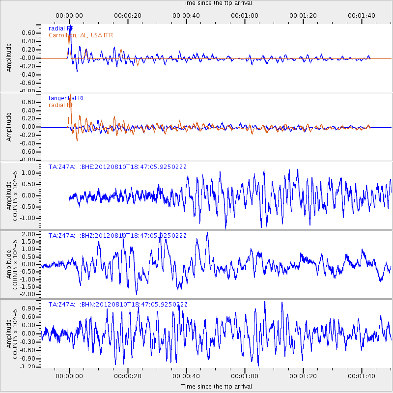
Earthquake location: Fox Islands, Aleutian Islands
Earthquake latitude/longitude: 52.6/-167.4
Earthquake time(UTC): 2012/08/10 (223) 18:37:43 GMT
Earthquake Depth: 13 km
Earthquake Magnitude: 5.9 MB, 6.2 MS, 6.2 MW, 6.2 MW
Earthquake Catalog/Contributor: WHDF/NEIC
Network: TA USArray Transportable Network (new EarthScope stations)
Station: Z47A Carrollton, AL, USA
Lat/Lon: 33.20 N/88.07 W
Elevation: 65 m
Distance: 58.2 deg
Az: 75.746 deg
Baz: 315.207 deg
Ray Param: 0.06297186
Estimated Moho Depth: 32.25 km
Estimated Crust Vp/Vs: 2.08
Assumed Crust Vp: 6.201 km/s
Estimated Crust Vs: 2.978 km/s
Estimated Crust Poisson's Ratio: 0.35
Radial Match: 92.54644 %
Radial Bump: 400
Transverse Match: 74.00499 %
Transverse Bump: 400
SOD ConfigId: 469095
Insert Time: 2013-02-22 05:58:31.137 +0000
GWidth: 2.5
Max Bumps: 400
Tol: 0.001

Signal To Noise

ChannelStoNSTALTA
TA:Z47A: :BHZ:20120810T18:47:05.925022Z4.52275134.9034094E-71.0841651E-7
TA:Z47A: :BHN:20120810T18:47:05.925022Z1.72944762.1744096E-71.2572855E-7
TA:Z47A: :BHE:20120810T18:47:05.925022Z1.62129252.334182E-71.4397045E-7
Arrivals
Ps5.9 SECOND
PpPs15 SECOND
PsPs/PpSs21 SECOND