V41A Mountainview, AR, USA - Earthquake Result Viewer
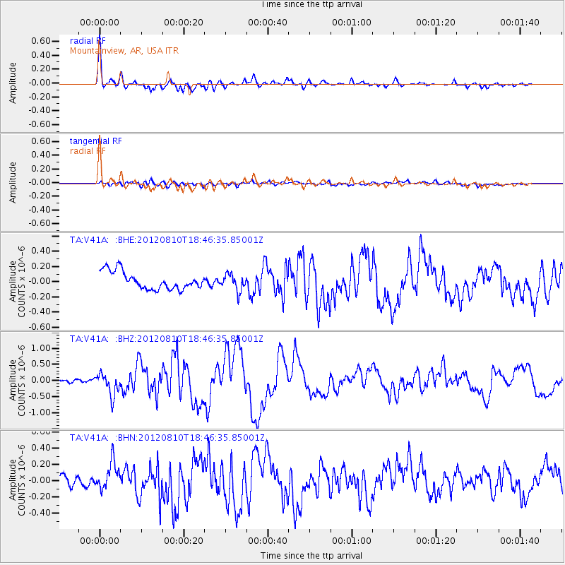
Earthquake location: Fox Islands, Aleutian Islands
Earthquake latitude/longitude: 52.6/-167.4
Earthquake time(UTC): 2012/08/10 (223) 18:37:43 GMT
Earthquake Depth: 13 km
Earthquake Magnitude: 5.9 MB, 6.2 MS, 6.2 MW, 6.2 MW
Earthquake Catalog/Contributor: WHDF/NEIC
Network: TA USArray Transportable Network (new EarthScope stations)
Station: V41A Mountainview, AR, USA
Lat/Lon: 35.79 N/92.16 W
Elevation: 413 m
Distance: 54.0 deg
Az: 76.356 deg
Baz: 313.242 deg
Ray Param: 0.065705635
Estimated Moho Depth: 42.25 km
Estimated Crust Vp/Vs: 1.76
Assumed Crust Vp: 6.498 km/s
Estimated Crust Vs: 3.697 km/s
Estimated Crust Poisson's Ratio: 0.26
Radial Match: 88.94385 %
Radial Bump: 400
Transverse Match: 60.72 %
Transverse Bump: 400
SOD ConfigId: 469095
Insert Time: 2013-02-22 05:59:07.713 +0000
GWidth: 2.5
Max Bumps: 400
Tol: 0.001

Signal To Noise

ChannelStoNSTALTA
TA:V41A: :BHZ:20120810T18:46:35.85001Z5.7863483.559154E-76.15095E-8
TA:V41A: :BHN:20120810T18:46:35.85001Z3.0121821.8785275E-76.236434E-8
TA:V41A: :BHE:20120810T18:46:35.85001Z0.95112961.0962635E-71.15259105E-7
Arrivals
Ps5.2 SECOND
PpPs17 SECOND
PsPs/PpSs22 SECOND