V42A Cord, AR, USA - Earthquake Result Viewer
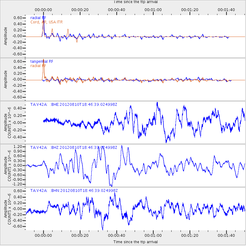
Earthquake location: Fox Islands, Aleutian Islands
Earthquake latitude/longitude: 52.6/-167.4
Earthquake time(UTC): 2012/08/10 (223) 18:37:43 GMT
Earthquake Depth: 13 km
Earthquake Magnitude: 5.9 MB, 6.2 MS, 6.2 MW, 6.2 MW
Earthquake Catalog/Contributor: WHDF/NEIC
Network: TA USArray Transportable Network (new EarthScope stations)
Station: V42A Cord, AR, USA
Lat/Lon: 35.81 N/91.39 W
Elevation: 134 m
Distance: 54.5 deg
Az: 75.811 deg
Baz: 313.37 deg
Ray Param: 0.06543135
Estimated Moho Depth: 39.0 km
Estimated Crust Vp/Vs: 1.80
Assumed Crust Vp: 6.273 km/s
Estimated Crust Vs: 3.495 km/s
Estimated Crust Poisson's Ratio: 0.27
Radial Match: 93.241455 %
Radial Bump: 400
Transverse Match: 44.826435 %
Transverse Bump: 400
SOD ConfigId: 469095
Insert Time: 2013-02-22 05:59:13.360 +0000
GWidth: 2.5
Max Bumps: 400
Tol: 0.001

Signal To Noise

ChannelStoNSTALTA
TA:V42A: :BHZ:20120810T18:46:39.024998Z4.98902273.1395797E-76.292975E-8
TA:V42A: :BHN:20120810T18:46:39.024998Z0.82828361.2271761E-71.4815892E-7
TA:V42A: :BHE:20120810T18:46:39.024998Z2.47108861.569816E-76.35273E-8
Arrivals
Ps5.2 SECOND
PpPs17 SECOND
PsPs/PpSs22 SECOND