
S45A Carrier Mills, IL, USA - Earthquake Result Viewer
| ||||||||||||||||||
| ||||||||||||||||||
| ||||||||||||||||||
|
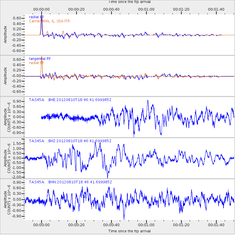
Signal To Noise
| Channel | StoN | STA | LTA |
| TA:S45A: :BHZ:20120810T18:46:41.699985Z | 4.142675 | 3.7979285E-7 | 9.167817E-8 |
| TA:S45A: :BHN:20120810T18:46:41.699985Z | 2.1950612 | 2.1680097E-7 | 9.876762E-8 |
| TA:S45A: :BHE:20120810T18:46:41.699985Z | 1.753688 | 1.7315912E-7 | 9.873998E-8 |
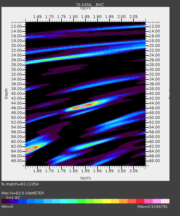
| Arrivals | |
| Ps | 6.4 SECOND |
| PpPs | 24 SECOND |
| PsPs/PpSs | 31 SECOND |

