Q43A New Douglas, IL, USA - Earthquake Result Viewer
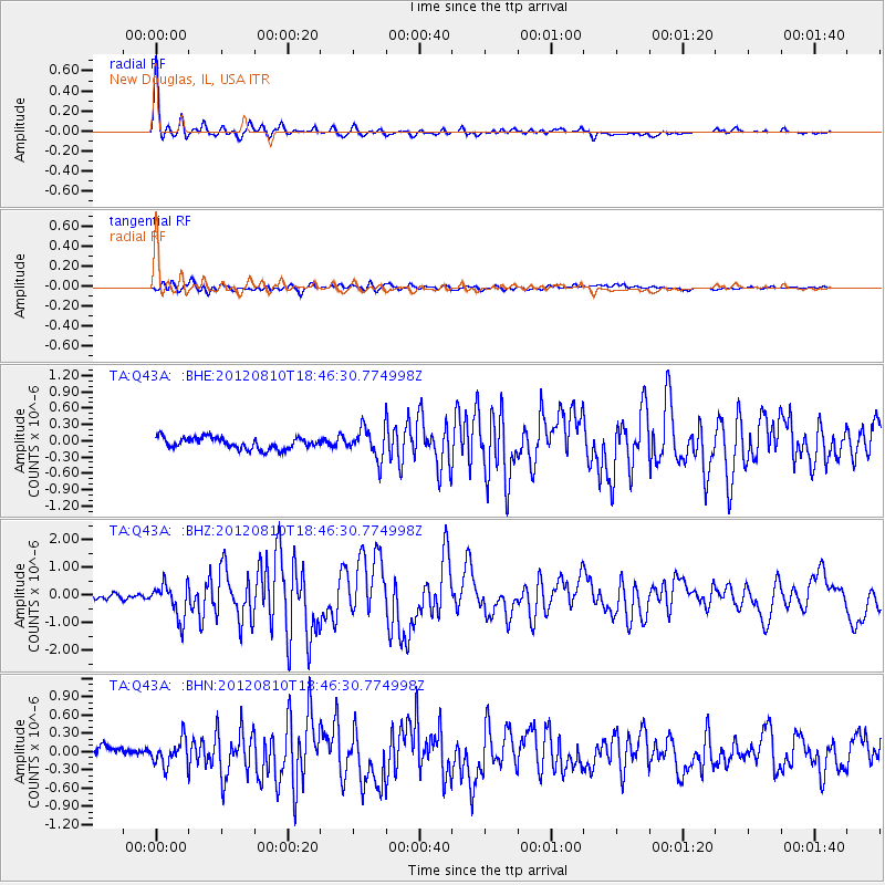
Earthquake location: Fox Islands, Aleutian Islands
Earthquake latitude/longitude: 52.6/-167.4
Earthquake time(UTC): 2012/08/10 (223) 18:37:43 GMT
Earthquake Depth: 13 km
Earthquake Magnitude: 5.9 MB, 6.2 MS, 6.2 MW, 6.2 MW
Earthquake Catalog/Contributor: WHDF/NEIC
Network: TA USArray Transportable Network (new EarthScope stations)
Station: Q43A New Douglas, IL, USA
Lat/Lon: 38.94 N/89.70 W
Elevation: 202 m
Distance: 53.3 deg
Az: 71.834 deg
Baz: 312.047 deg
Ray Param: 0.06617125
Estimated Moho Depth: 19.5 km
Estimated Crust Vp/Vs: 1.60
Assumed Crust Vp: 6.444 km/s
Estimated Crust Vs: 4.021 km/s
Estimated Crust Poisson's Ratio: 0.18
Radial Match: 95.44747 %
Radial Bump: 352
Transverse Match: 78.10541 %
Transverse Bump: 400
SOD ConfigId: 469095
Insert Time: 2013-02-22 05:59:41.188 +0000
GWidth: 2.5
Max Bumps: 400
Tol: 0.001

Signal To Noise

ChannelStoNSTALTA
TA:Q43A: :BHZ:20120810T18:46:30.774998Z6.2262836.1235477E-79.8349965E-8
TA:Q43A: :BHN:20120810T18:46:30.774998Z2.40873842.0883024E-78.6696936E-8
TA:Q43A: :BHE:20120810T18:46:30.774998Z2.66135172.772374E-71.04171654E-7
Arrivals
Ps1.9 SECOND
PpPs7.4 SECOND
PsPs/PpSs9.3 SECOND