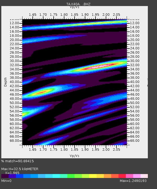
K40A Colesburg, IA, USA - Earthquake Result Viewer
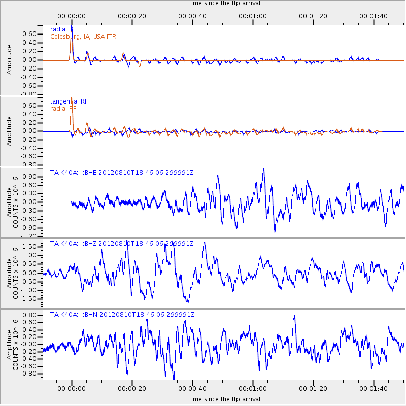
Earthquake location: Fox Islands, Aleutian Islands
Earthquake latitude/longitude: 52.6/-167.4
Earthquake time(UTC): 2012/08/10 (223) 18:37:43 GMT
Earthquake Depth: 13 km
Earthquake Magnitude: 5.9 MB, 6.2 MS, 6.2 MW, 6.2 MW
Earthquake Catalog/Contributor: WHDF/NEIC
Network: TA USArray Transportable Network (new EarthScope stations)
Station: K40A Colesburg, IA, USA
Lat/Lon: 42.70 N/91.14 W
Elevation: 274 m
Distance: 50.0 deg
Az: 69.116 deg
Baz: 309.424 deg
Ray Param: 0.06830919
Estimated Moho Depth: 32.5 km
Estimated Crust Vp/Vs: 1.97
Assumed Crust Vp: 6.53 km/s
Estimated Crust Vs: 3.323 km/s
Estimated Crust Poisson's Ratio: 0.33
Radial Match: 90.69415 %
Radial Bump: 400
Transverse Match: 66.987045 %
Transverse Bump: 400
SOD ConfigId: 469095
Insert Time: 2013-02-22 06:00:04.802 +0000
GWidth: 2.5
Max Bumps: 400
Tol: 0.001

Signal To Noise

ChannelStoNSTALTA
TA:K40A: :BHZ:20120810T18:46:06.299991Z3.662724.4477653E-71.2143339E-7
TA:K40A: :BHN:20120810T18:46:06.299991Z2.08065771.6749621E-78.050157E-8
TA:K40A: :BHE:20120810T18:46:06.299991Z1.98665992.2572927E-71.13622505E-7
Arrivals
Ps5.1 SECOND
PpPs14 SECOND
PsPs/PpSs19 SECOND