
P42A Winchester, IL, USA - Earthquake Result Viewer
| ||||||||||||||||||
| ||||||||||||||||||
| ||||||||||||||||||
|
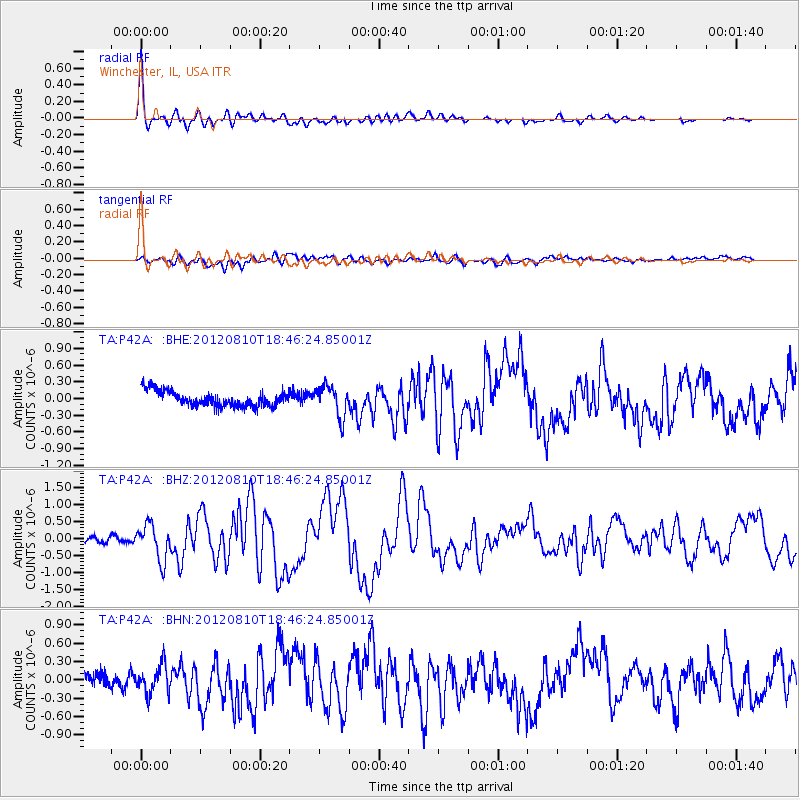
Signal To Noise
| Channel | StoN | STA | LTA |
| TA:P42A: :BHZ:20120810T18:46:24.85001Z | 6.4917793 | 5.216978E-7 | 8.036284E-8 |
| TA:P42A: :BHN:20120810T18:46:24.85001Z | 1.7463443 | 2.2600084E-7 | 1.2941368E-7 |
| TA:P42A: :BHE:20120810T18:46:24.85001Z | 2.0538769 | 2.7861907E-7 | 1.356552E-7 |
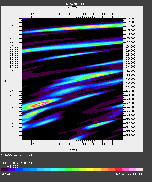
| Arrivals | |
| Ps | 5.9 SECOND |
| PpPs | 20 SECOND |
| PsPs/PpSs | 26 SECOND |

