L40A Anamosa, IA, USA - Earthquake Result Viewer
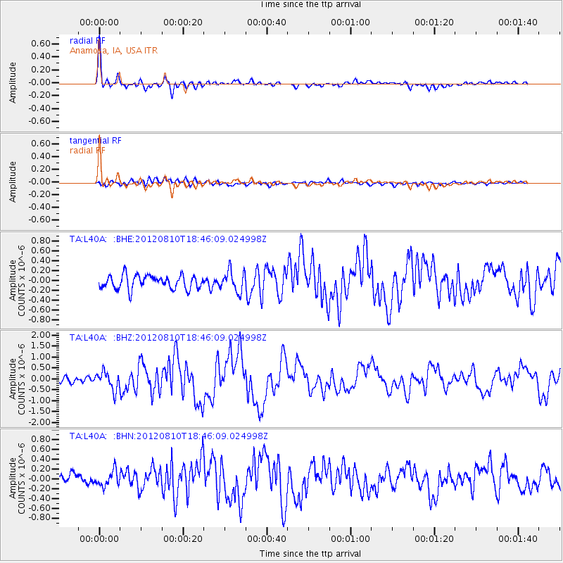
Earthquake location: Fox Islands, Aleutian Islands
Earthquake latitude/longitude: 52.6/-167.4
Earthquake time(UTC): 2012/08/10 (223) 18:37:43 GMT
Earthquake Depth: 13 km
Earthquake Magnitude: 5.9 MB, 6.2 MS, 6.2 MW, 6.2 MW
Earthquake Catalog/Contributor: WHDF/NEIC
Network: TA USArray Transportable Network (new EarthScope stations)
Station: L40A Anamosa, IA, USA
Lat/Lon: 42.06 N/91.22 W
Elevation: 242 m
Distance: 50.4 deg
Az: 69.806 deg
Baz: 309.809 deg
Ray Param: 0.06807527
Estimated Moho Depth: 33.0 km
Estimated Crust Vp/Vs: 1.79
Assumed Crust Vp: 6.53 km/s
Estimated Crust Vs: 3.648 km/s
Estimated Crust Poisson's Ratio: 0.27
Radial Match: 91.48372 %
Radial Bump: 400
Transverse Match: 50.174217 %
Transverse Bump: 400
SOD ConfigId: 469095
Insert Time: 2013-02-22 06:00:47.254 +0000
GWidth: 2.5
Max Bumps: 400
Tol: 0.001

Signal To Noise

ChannelStoNSTALTA
TA:L40A: :BHZ:20120810T18:46:09.024998Z2.85117774.1787362E-71.4656176E-7
TA:L40A: :BHN:20120810T18:46:09.024998Z1.44212031.702186E-71.1803356E-7
TA:L40A: :BHE:20120810T18:46:09.024998Z1.56673362.157175E-71.3768614E-7
Arrivals
Ps4.2 SECOND
PpPs13 SECOND
PsPs/PpSs18 SECOND