U42A Revenden, AR, USA - Earthquake Result Viewer
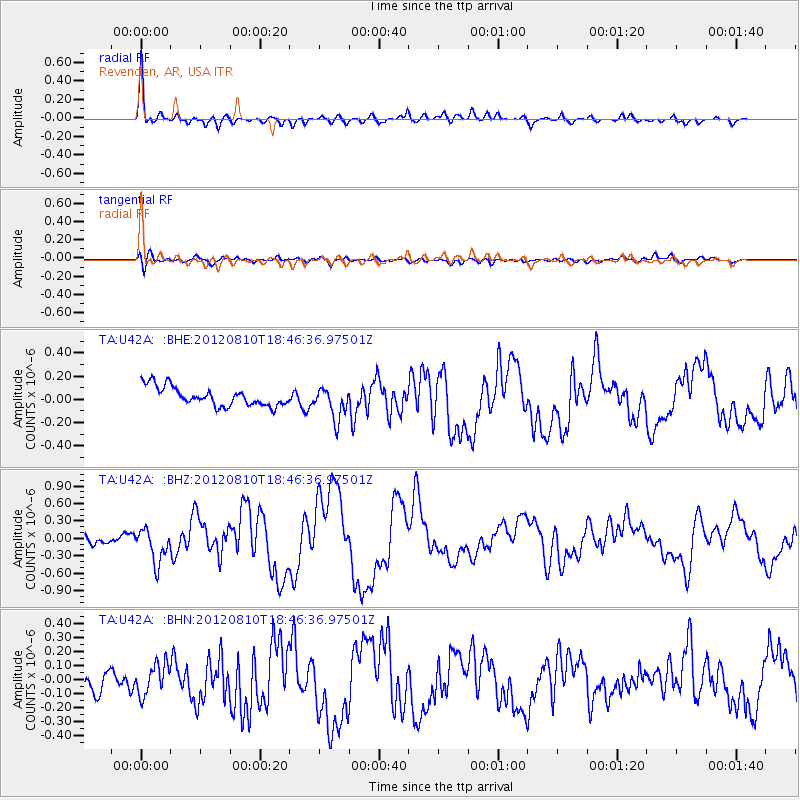
Earthquake location: Fox Islands, Aleutian Islands
Earthquake latitude/longitude: 52.6/-167.4
Earthquake time(UTC): 2012/08/10 (223) 18:37:43 GMT
Earthquake Depth: 13 km
Earthquake Magnitude: 5.9 MB, 6.2 MS, 6.2 MW, 6.2 MW
Earthquake Catalog/Contributor: WHDF/NEIC
Network: TA USArray Transportable Network (new EarthScope stations)
Station: U42A Revenden, AR, USA
Lat/Lon: 36.35 N/91.24 W
Elevation: 119 m
Distance: 54.2 deg
Az: 75.219 deg
Baz: 313.114 deg
Ray Param: 0.06560822
Estimated Moho Depth: 31.75 km
Estimated Crust Vp/Vs: 1.66
Assumed Crust Vp: 6.53 km/s
Estimated Crust Vs: 3.922 km/s
Estimated Crust Poisson's Ratio: 0.22
Radial Match: 93.10827 %
Radial Bump: 400
Transverse Match: 64.33213 %
Transverse Bump: 400
SOD ConfigId: 469095
Insert Time: 2013-02-22 06:00:51.601 +0000
GWidth: 2.5
Max Bumps: 400
Tol: 0.001

Signal To Noise

ChannelStoNSTALTA
TA:U42A: :BHZ:20120810T18:46:36.97501Z4.65939662.9257845E-76.2793205E-8
TA:U42A: :BHN:20120810T18:46:36.97501Z1.96175321.1080712E-75.6483717E-8
TA:U42A: :BHE:20120810T18:46:36.97501Z1.66573511.3530955E-78.1231136E-8
Arrivals
Ps3.4 SECOND
PpPs12 SECOND
PsPs/PpSs16 SECOND