
U41A Viola, AR, USA - Earthquake Result Viewer
| ||||||||||||||||||
| ||||||||||||||||||
| ||||||||||||||||||
|
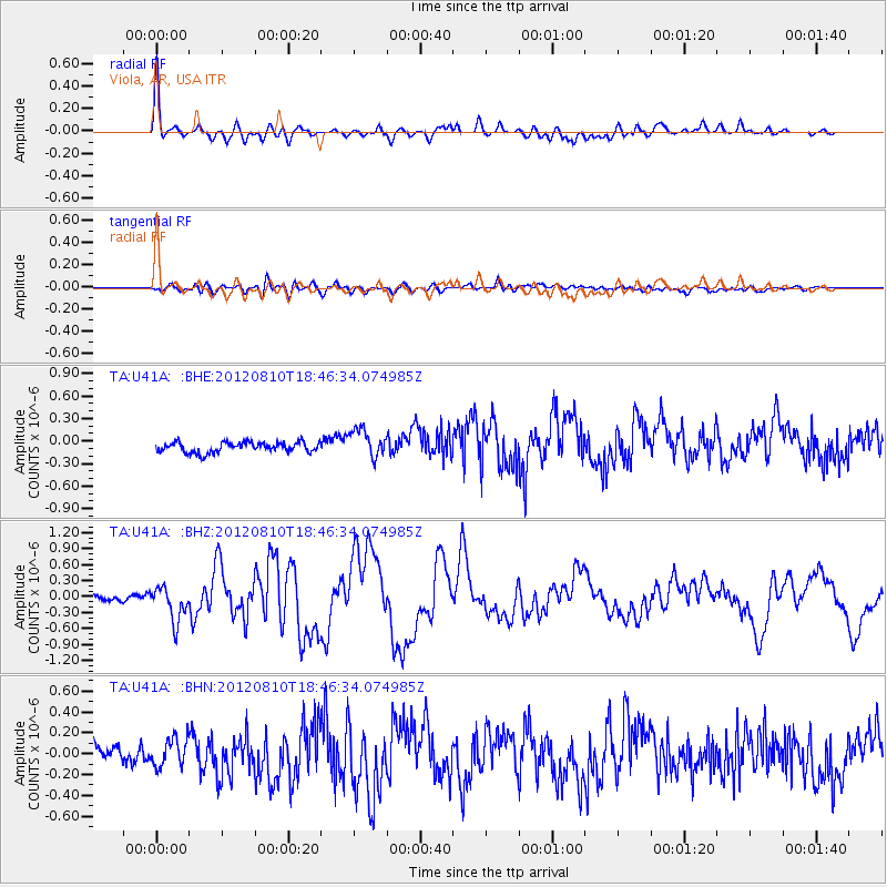
Signal To Noise
| Channel | StoN | STA | LTA |
| TA:U41A: :BHZ:20120810T18:46:34.074985Z | 4.521226 | 3.189655E-7 | 7.054845E-8 |
| TA:U41A: :BHN:20120810T18:46:34.074985Z | 1.4967172 | 1.3169175E-7 | 8.798707E-8 |
| TA:U41A: :BHE:20120810T18:46:34.074985Z | 2.7588882 | 1.8676697E-7 | 6.769646E-8 |
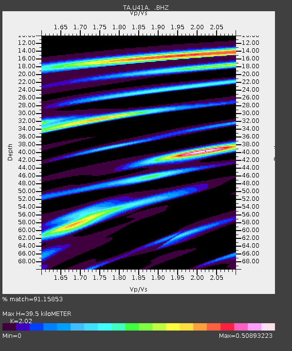
| Arrivals | |
| Ps | 6.5 SECOND |
| PpPs | 17 SECOND |
| PsPs/PpSs | 24 SECOND |

