
T44A Benton, MO, USA - Earthquake Result Viewer
| ||||||||||||||||||
| ||||||||||||||||||
| ||||||||||||||||||
|
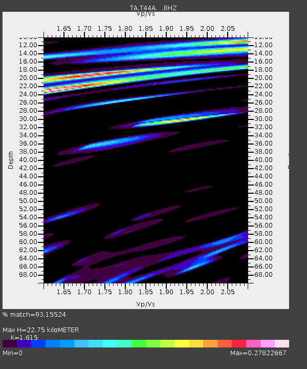
Signal To Noise
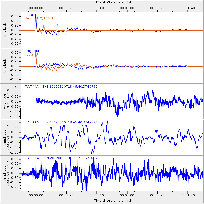
| Channel | StoN | STA | LTA |
| TA:T44A: :BHZ:20120810T18:46:40.374973Z | 4.4776673 | 4.3246828E-7 | 9.6583385E-8 |
| TA:T44A: :BHN:20120810T18:46:40.374973Z | 1.6014076 | 3.012145E-7 | 1.8809358E-7 |
| TA:T44A: :BHE:20120810T18:46:40.374973Z | 2.094423 | 3.046915E-7 | 1.4547754E-7 |
| Arrivals | |
| Ps | 2.3 SECOND |
| PpPs | 8.7 SECOND |
| PsPs/PpSs | 11 SECOND |

