
R42A Luebbering, MO, USA - Earthquake Result Viewer
| ||||||||||||||||||
| ||||||||||||||||||
| ||||||||||||||||||
|
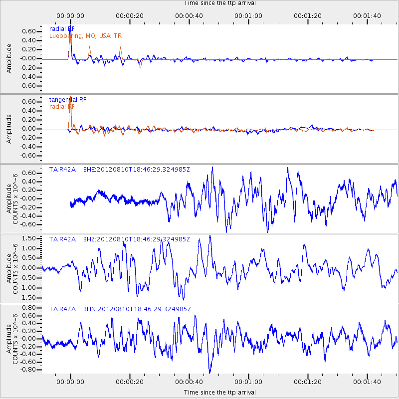
Signal To Noise
| Channel | StoN | STA | LTA |
| TA:R42A: :BHZ:20120810T18:46:29.324985Z | 6.2289267 | 4.5419492E-7 | 7.291704E-8 |
| TA:R42A: :BHN:20120810T18:46:29.324985Z | 1.777907 | 1.8648127E-7 | 1.04888095E-7 |
| TA:R42A: :BHE:20120810T18:46:29.324985Z | 2.5309637 | 2.069393E-7 | 8.1763055E-8 |
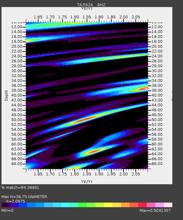
| Arrivals | |
| Ps | 6.5 SECOND |
| PpPs | 17 SECOND |
| PsPs/PpSs | 23 SECOND |

