
X42A Stuttgart, AR, USA - Earthquake Result Viewer
| ||||||||||||||||||
| ||||||||||||||||||
| ||||||||||||||||||
|
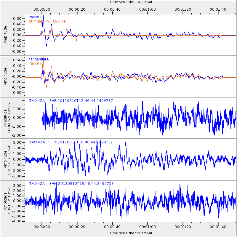
Signal To Noise
| Channel | StoN | STA | LTA |
| TA:X42A: :BHZ:20120810T18:46:44.249973Z | 2.128057 | 6.9846465E-7 | 3.2821708E-7 |
| TA:X42A: :BHN:20120810T18:46:44.249973Z | 1.4421877 | 8.7287515E-7 | 6.052438E-7 |
| TA:X42A: :BHE:20120810T18:46:44.249973Z | 0.89761573 | 5.067512E-7 | 5.6455247E-7 |
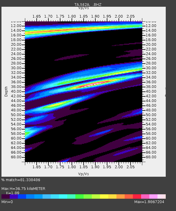
| Arrivals | |
| Ps | 5.5 SECOND |
| PpPs | 16 SECOND |
| PsPs/PpSs | 22 SECOND |

