M41A Milan, IL, USA - Earthquake Result Viewer
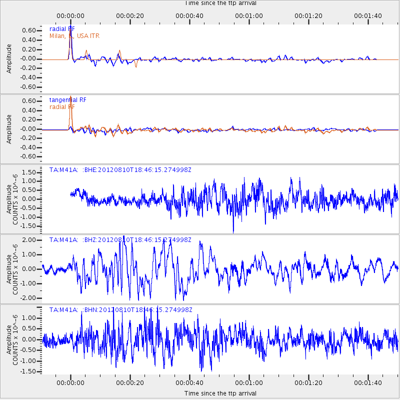
Earthquake location: Fox Islands, Aleutian Islands
Earthquake latitude/longitude: 52.6/-167.4
Earthquake time(UTC): 2012/08/10 (223) 18:37:43 GMT
Earthquake Depth: 13 km
Earthquake Magnitude: 5.9 MB, 6.2 MS, 6.2 MW, 6.2 MW
Earthquake Catalog/Contributor: WHDF/NEIC
Network: TA USArray Transportable Network (new EarthScope stations)
Station: M41A Milan, IL, USA
Lat/Lon: 41.38 N/90.54 W
Elevation: 226 m
Distance: 51.2 deg
Az: 70.061 deg
Baz: 310.421 deg
Ray Param: 0.06753598
Estimated Moho Depth: 26.25 km
Estimated Crust Vp/Vs: 1.85
Assumed Crust Vp: 6.498 km/s
Estimated Crust Vs: 3.507 km/s
Estimated Crust Poisson's Ratio: 0.29
Radial Match: 91.79871 %
Radial Bump: 317
Transverse Match: 47.92383 %
Transverse Bump: 400
SOD ConfigId: 469095
Insert Time: 2013-02-22 06:02:00.726 +0000
GWidth: 2.5
Max Bumps: 400
Tol: 0.001

Signal To Noise

ChannelStoNSTALTA
TA:M41A: :BHZ:20120810T18:46:15.274998Z4.80617956.393745E-71.3303175E-7
TA:M41A: :BHN:20120810T18:46:15.274998Z1.97756023.4121695E-71.725444E-7
TA:M41A: :BHE:20120810T18:46:15.274998Z1.45075983.3988744E-72.3428237E-7
Arrivals
Ps3.6 SECOND
PpPs11 SECOND
PsPs/PpSs15 SECOND