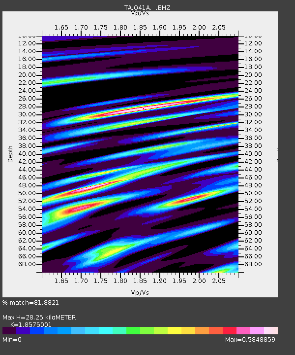
Q41A Truxton, MO, USA - Earthquake Result Viewer
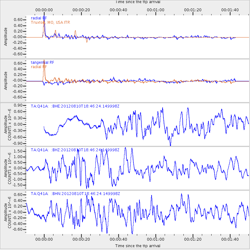
Earthquake location: Fox Islands, Aleutian Islands
Earthquake latitude/longitude: 52.6/-167.4
Earthquake time(UTC): 2012/08/10 (223) 18:37:43 GMT
Earthquake Depth: 13 km
Earthquake Magnitude: 5.9 MB, 6.2 MS, 6.2 MW, 6.2 MW
Earthquake Catalog/Contributor: WHDF/NEIC
Network: TA USArray Transportable Network (new EarthScope stations)
Station: Q41A Truxton, MO, USA
Lat/Lon: 38.95 N/91.23 W
Elevation: 191 m
Distance: 52.4 deg
Az: 72.822 deg
Baz: 311.684 deg
Ray Param: 0.066762485
Estimated Moho Depth: 28.25 km
Estimated Crust Vp/Vs: 1.86
Assumed Crust Vp: 6.498 km/s
Estimated Crust Vs: 3.498 km/s
Estimated Crust Poisson's Ratio: 0.30
Radial Match: 81.8821 %
Radial Bump: 400
Transverse Match: 30.354795 %
Transverse Bump: 400
SOD ConfigId: 469095
Insert Time: 2013-02-22 06:02:21.512 +0000
GWidth: 2.5
Max Bumps: 400
Tol: 0.001

Signal To Noise

ChannelStoNSTALTA
TA:Q41A: :BHZ:20120810T18:46:24.149998Z5.55865145.3426777E-79.611463E-8
TA:Q41A: :BHN:20120810T18:46:24.149998Z1.11898972.033462E-71.8172304E-7
TA:Q41A: :BHE:20120810T18:46:24.149998Z0.95224192.725358E-72.8620437E-7
Arrivals
Ps3.9 SECOND
PpPs12 SECOND
PsPs/PpSs16 SECOND