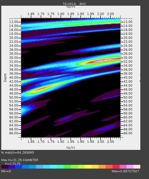
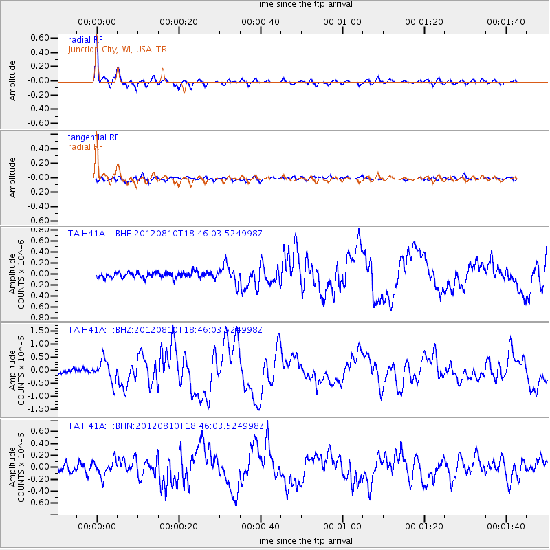
H41A Junction City, WI, USA - Earthquake Result Viewer

Earthquake location: Fox Islands, Aleutian Islands
Earthquake latitude/longitude: 52.6/-167.4
Earthquake time(UTC): 2012/08/10 (223) 18:37:43 GMT
Earthquake Depth: 13 km
Earthquake Magnitude: 5.9 MB, 6.2 MS, 6.2 MW, 6.2 MW
Earthquake Catalog/Contributor: WHDF/NEIC
Network: TA USArray Transportable Network (new EarthScope stations)
Station: H41A Junction City, WI, USA
Lat/Lon: 44.62 N/89.65 W
Elevation: 348 m
Distance: 49.7 deg
Az: 66.281 deg
Baz: 308.618 deg
Ray Param: 0.06854368
Estimated Moho Depth: 31.25 km
Estimated Crust Vp/Vs: 2.01
Assumed Crust Vp: 6.41 km/s
Estimated Crust Vs: 3.185 km/s
Estimated Crust Poisson's Ratio: 0.34
Radial Match: 94.285995 %
Radial Bump: 380
Transverse Match: 68.86747 %
Transverse Bump: 400
SOD ConfigId: 469095
Insert Time: 2013-02-22 06:02:47.216 +0000
GWidth: 2.5
Max Bumps: 400
Tol: 0.001

Signal To Noise

ChannelStoNSTALTA
TA:H41A: :BHZ:20120810T18:46:03.524998Z5.9994274.1922053E-76.987676E-8
TA:H41A: :BHN:20120810T18:46:03.524998Z2.0452521.333369E-76.5193376E-8
TA:H41A: :BHE:20120810T18:46:03.524998Z3.09336331.618879E-75.2333938E-8
Arrivals
Ps5.2 SECOND
PpPs14 SECOND
PsPs/PpSs19 SECOND