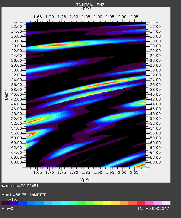
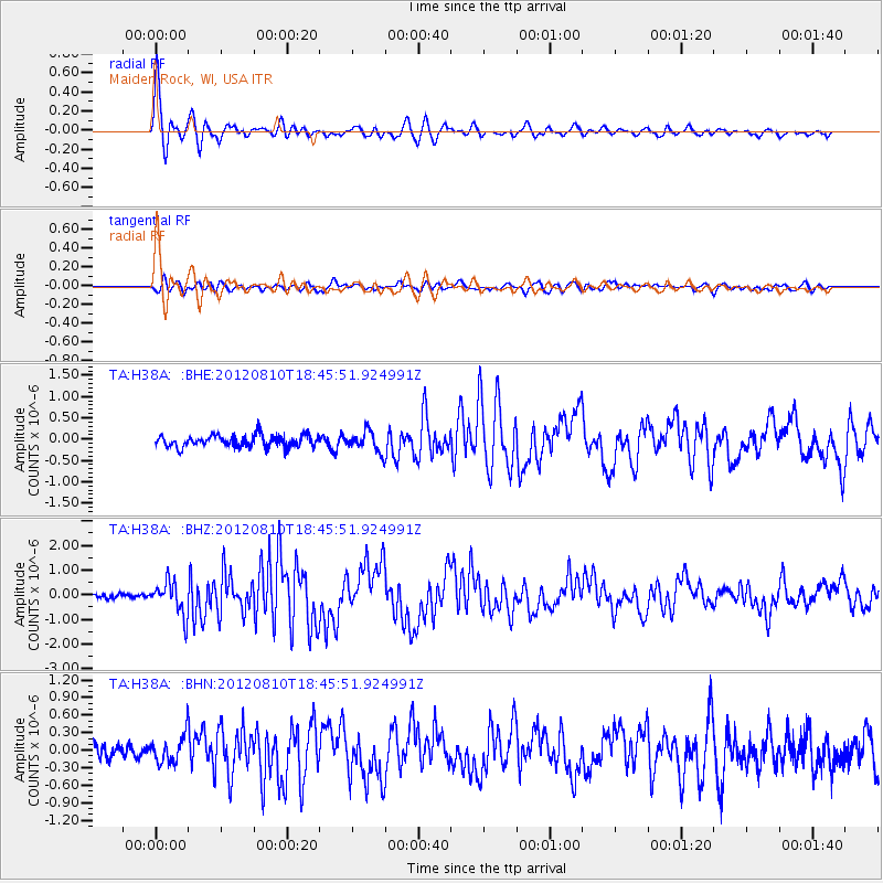
H38A Maiden Rock, WI, USA - Earthquake Result Viewer

Earthquake location: Fox Islands, Aleutian Islands
Earthquake latitude/longitude: 52.6/-167.4
Earthquake time(UTC): 2012/08/10 (223) 18:37:43 GMT
Earthquake Depth: 13 km
Earthquake Magnitude: 5.9 MB, 6.2 MS, 6.2 MW, 6.2 MW
Earthquake Catalog/Contributor: WHDF/NEIC
Network: TA USArray Transportable Network (new EarthScope stations)
Station: H38A Maiden Rock, WI, USA
Lat/Lon: 44.68 N/92.28 W
Elevation: 333 m
Distance: 48.2 deg
Az: 67.759 deg
Baz: 307.747 deg
Ray Param: 0.069528274
Estimated Moho Depth: 56.75 km
Estimated Crust Vp/Vs: 1.60
Assumed Crust Vp: 6.571 km/s
Estimated Crust Vs: 4.107 km/s
Estimated Crust Poisson's Ratio: 0.18
Radial Match: 89.82451 %
Radial Bump: 400
Transverse Match: 73.18735 %
Transverse Bump: 400
SOD ConfigId: 469095
Insert Time: 2013-02-22 06:02:57.275 +0000
GWidth: 2.5
Max Bumps: 400
Tol: 0.001

Signal To Noise

ChannelStoNSTALTA
TA:H38A: :BHZ:20120810T18:45:51.924991Z7.1197366.7207634E-79.439624E-8
TA:H38A: :BHN:20120810T18:45:51.924991Z1.61028162.3036783E-71.4306059E-7
TA:H38A: :BHE:20120810T18:45:51.924991Z1.75387182.3899128E-71.3626496E-7
Arrivals
Ps5.6 SECOND
PpPs21 SECOND
PsPs/PpSs26 SECOND