
N42A Yates City, IL, USA - Earthquake Result Viewer
| ||||||||||||||||||
| ||||||||||||||||||
| ||||||||||||||||||
|
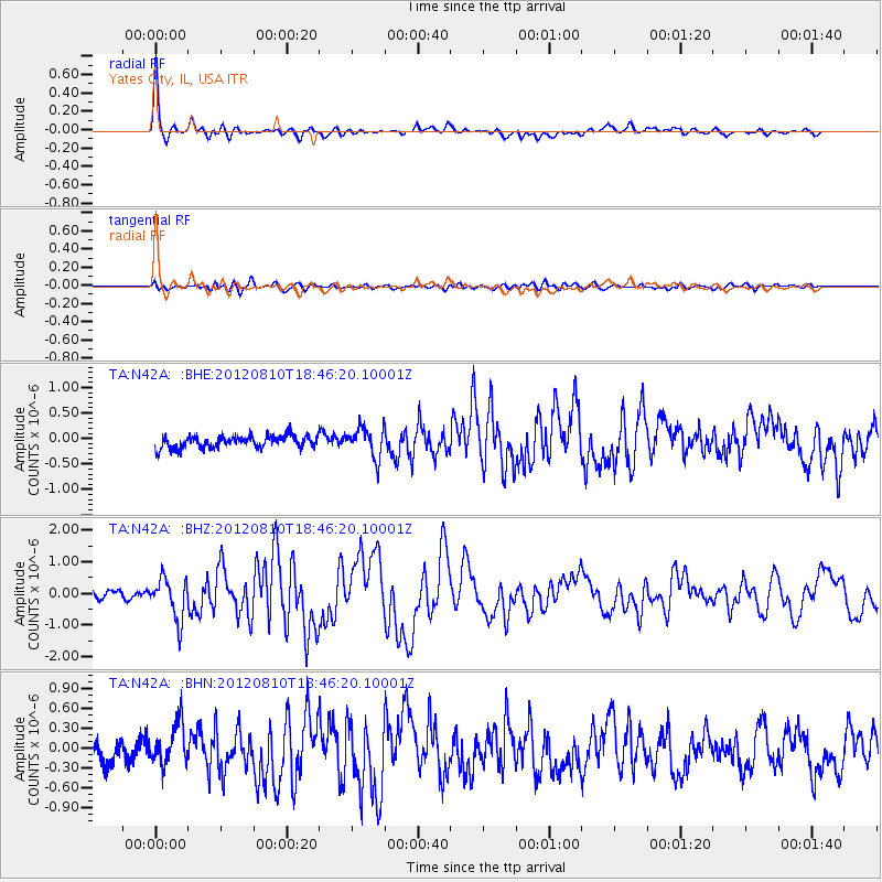
Signal To Noise
| Channel | StoN | STA | LTA |
| TA:N42A: :BHZ:20120810T18:46:20.10001Z | 5.6145673 | 6.520998E-7 | 1.16144264E-7 |
| TA:N42A: :BHN:20120810T18:46:20.10001Z | 2.3730867 | 3.1364993E-7 | 1.321696E-7 |
| TA:N42A: :BHE:20120810T18:46:20.10001Z | 2.407557 | 2.868029E-7 | 1.1912611E-7 |
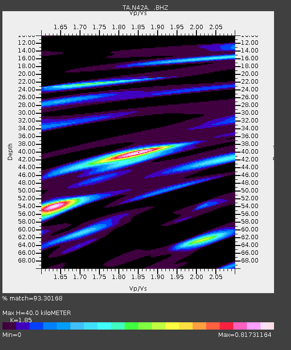
| Arrivals | |
| Ps | 5.5 SECOND |
| PpPs | 17 SECOND |
| PsPs/PpSs | 22 SECOND |

