F40A Park Falls, WI, USA - Earthquake Result Viewer
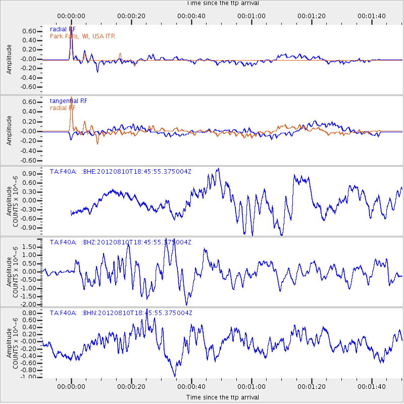
Earthquake location: Fox Islands, Aleutian Islands
Earthquake latitude/longitude: 52.6/-167.4
Earthquake time(UTC): 2012/08/10 (223) 18:37:43 GMT
Earthquake Depth: 13 km
Earthquake Magnitude: 5.9 MB, 6.2 MS, 6.2 MW, 6.2 MW
Earthquake Catalog/Contributor: WHDF/NEIC
Network: TA USArray Transportable Network (new EarthScope stations)
Station: F40A Park Falls, WI, USA
Lat/Lon: 45.92 N/90.12 W
Elevation: 486 m
Distance: 48.6 deg
Az: 65.196 deg
Baz: 307.576 deg
Ray Param: 0.069240145
Estimated Moho Depth: 42.5 km
Estimated Crust Vp/Vs: 1.65
Assumed Crust Vp: 6.571 km/s
Estimated Crust Vs: 3.982 km/s
Estimated Crust Poisson's Ratio: 0.21
Radial Match: 85.6284 %
Radial Bump: 400
Transverse Match: 39.36799 %
Transverse Bump: 400
SOD ConfigId: 469095
Insert Time: 2013-02-22 06:03:58.502 +0000
GWidth: 2.5
Max Bumps: 400
Tol: 0.001

Signal To Noise

ChannelStoNSTALTA
TA:F40A: :BHZ:20120810T18:45:55.375004Z4.57194.5672226E-79.98977E-8
TA:F40A: :BHN:20120810T18:45:55.375004Z2.76024844.8405707E-71.7536722E-7
TA:F40A: :BHE:20120810T18:45:55.375004Z1.1983672.9518313E-72.4632112E-7
Arrivals
Ps4.5 SECOND
PpPs16 SECOND
PsPs/PpSs21 SECOND