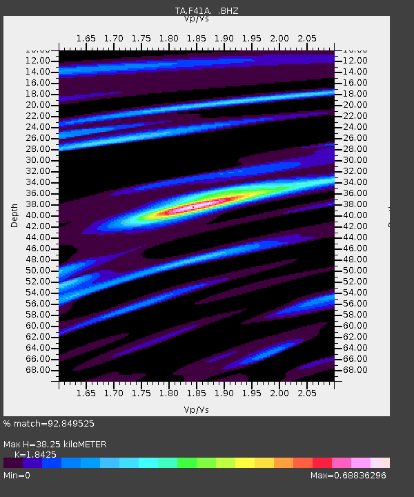
F41A Wisconsin Rapids, WI, USA - Earthquake Result Viewer
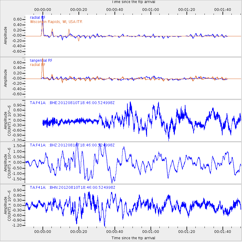
Earthquake location: Fox Islands, Aleutian Islands
Earthquake latitude/longitude: 52.6/-167.4
Earthquake time(UTC): 2012/08/10 (223) 18:37:43 GMT
Earthquake Depth: 13 km
Earthquake Magnitude: 5.9 MB, 6.2 MS, 6.2 MW, 6.2 MW
Earthquake Catalog/Contributor: WHDF/NEIC
Network: TA USArray Transportable Network (new EarthScope stations)
Station: F41A Wisconsin Rapids, WI, USA
Lat/Lon: 45.74 N/89.10 W
Elevation: 509 m
Distance: 49.3 deg
Az: 64.806 deg
Baz: 308.047 deg
Ray Param: 0.068792604
Estimated Moho Depth: 38.25 km
Estimated Crust Vp/Vs: 1.84
Assumed Crust Vp: 6.41 km/s
Estimated Crust Vs: 3.479 km/s
Estimated Crust Poisson's Ratio: 0.29
Radial Match: 92.849525 %
Radial Bump: 320
Transverse Match: 56.090187 %
Transverse Bump: 400
SOD ConfigId: 469095
Insert Time: 2013-02-22 06:04:08.015 +0000
GWidth: 2.5
Max Bumps: 400
Tol: 0.001

Signal To Noise

ChannelStoNSTALTA
TA:F41A: :BHZ:20120810T18:46:00.524998Z3.78284294.6259225E-71.2228693E-7
TA:F41A: :BHN:20120810T18:46:00.524998Z1.25128471.6773647E-71.340514E-7
TA:F41A: :BHE:20120810T18:46:00.524998Z1.88837562.0373402E-71.078885E-7
Arrivals
Ps5.3 SECOND
PpPs16 SECOND
PsPs/PpSs21 SECOND