
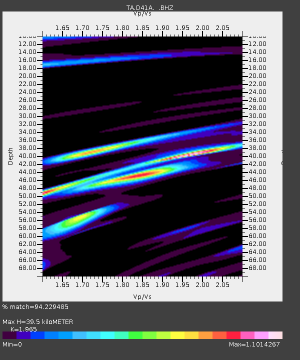
D41A Chassel, MI, USA - Earthquake Result Viewer
| ||||||||||||||||||
| ||||||||||||||||||
| ||||||||||||||||||
|
Signal To Noise
| Channel | StoN | STA | LTA |
| TA:D41A: :BHZ:20120810T18:45:56.60001Z | 2.676678 | 5.0377116E-7 | 1.8820761E-7 |
| TA:D41A: :BHN:20120810T18:45:56.60001Z | 1.5887487 | 3.141682E-7 | 1.9774569E-7 |
| TA:D41A: :BHE:20120810T18:45:56.60001Z | 1.4106318 | 2.3184108E-7 | 1.6435266E-7 |
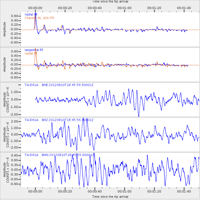
| Arrivals | |
| Ps | 6.2 SECOND |
| PpPs | 17 SECOND |
| PsPs/PpSs | 23 SECOND |

