You are here: Home > Network List > TA - USArray Transportable Network (new EarthScope stations) Stations List
> Station E44A Grand Marais Airport, Grand Marais, MI, USA > Earthquake Result Viewer
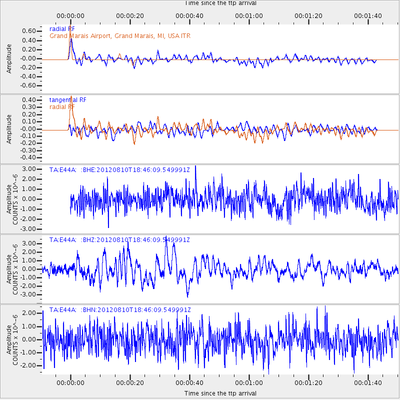
E44A Grand Marais Airport, Grand Marais, MI, USA - Earthquake Result Viewer
*The percent match for this event was below the threshold and hence no stack was calculated.
| Earthquake location: |
Fox Islands, Aleutian Islands |
| Earthquake latitude/longitude: |
52.6/-167.4 |
| Earthquake time(UTC): |
2012/08/10 (223) 18:37:43 GMT |
| Earthquake Depth: |
13 km |
| Earthquake Magnitude: |
5.9 MB, 6.2 MS, 6.2 MW, 6.2 MW |
| Earthquake Catalog/Contributor: |
WHDF/NEIC |
|
| Network: |
TA USArray Transportable Network (new EarthScope stations) |
| Station: |
E44A Grand Marais Airport, Grand Marais, MI, USA |
| Lat/Lon: |
46.62 N/85.92 W |
| Elevation: |
282 m |
|
| Distance: |
50.5 deg |
| Az: |
62.109 deg |
| Baz: |
308.598 deg |
| Ray Param: |
$rayparam |
*The percent match for this event was below the threshold and hence was not used in the summary stack. |
|
| Radial Match: |
77.72204 % |
| Radial Bump: |
400 |
| Transverse Match: |
65.722374 % |
| Transverse Bump: |
400 |
| SOD ConfigId: |
469095 |
| Insert Time: |
2013-02-22 06:05:08.944 +0000 |
| GWidth: |
2.5 |
| Max Bumps: |
400 |
| Tol: |
0.001 |
|
Signal To Noise
| Channel | StoN | STA | LTA |
| TA:E44A: :BHZ:20120810T18:46:09.549991Z | 1.6801052 | 7.092107E-7 | 4.221228E-7 |
| TA:E44A: :BHN:20120810T18:46:09.549991Z | 0.85171187 | 6.615285E-7 | 7.7670455E-7 |
| TA:E44A: :BHE:20120810T18:46:09.549991Z | 1.1707534 | 8.895878E-7 | 7.598422E-7 |
| Arrivals |
| Ps | |
| PpPs | |
| PsPs/PpSs | |


