N45A Kentland, IN, USA - Earthquake Result Viewer
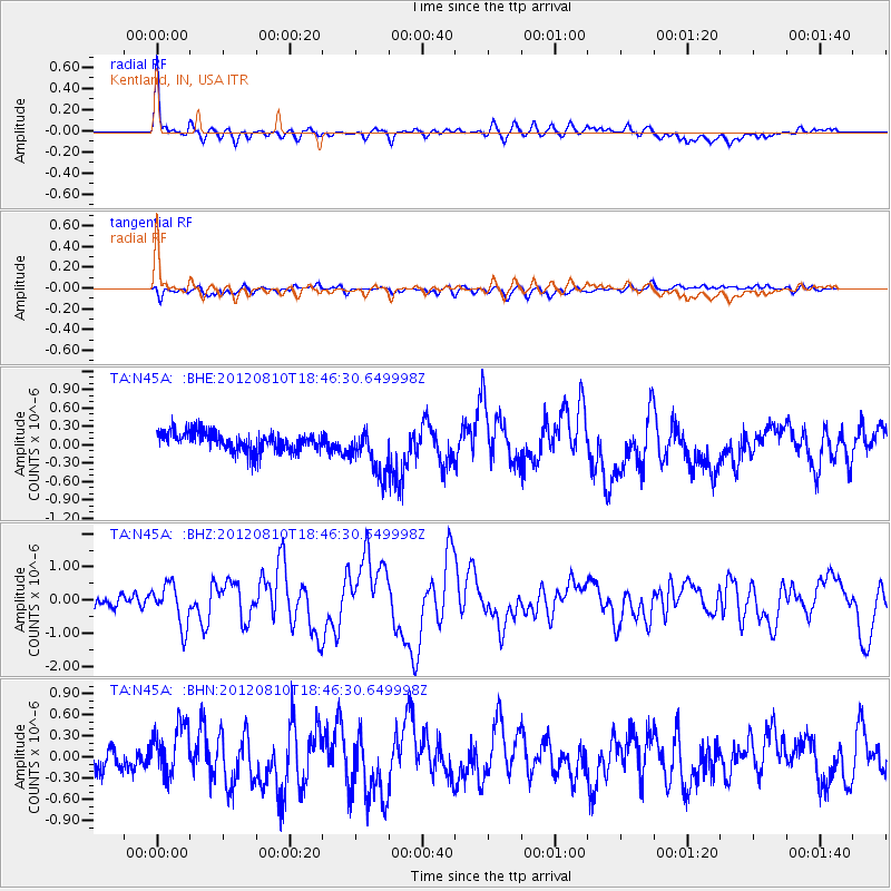
Earthquake location: Fox Islands, Aleutian Islands
Earthquake latitude/longitude: 52.6/-167.4
Earthquake time(UTC): 2012/08/10 (223) 18:37:43 GMT
Earthquake Depth: 13 km
Earthquake Magnitude: 5.9 MB, 6.2 MS, 6.2 MW, 6.2 MW
Earthquake Catalog/Contributor: WHDF/NEIC
Network: TA USArray Transportable Network (new EarthScope stations)
Station: N45A Kentland, IN, USA
Lat/Lon: 40.85 N/87.51 W
Elevation: 206 m
Distance: 53.3 deg
Az: 68.664 deg
Baz: 311.551 deg
Ray Param: 0.066181146
Estimated Moho Depth: 53.5 km
Estimated Crust Vp/Vs: 1.96
Assumed Crust Vp: 6.498 km/s
Estimated Crust Vs: 3.311 km/s
Estimated Crust Poisson's Ratio: 0.32
Radial Match: 80.27077 %
Radial Bump: 400
Transverse Match: 43.085724 %
Transverse Bump: 400
SOD ConfigId: 469095
Insert Time: 2013-02-22 06:06:14.099 +0000
GWidth: 2.5
Max Bumps: 400
Tol: 0.001

Signal To Noise

ChannelStoNSTALTA
TA:N45A: :BHZ:20120810T18:46:30.649998Z3.22241886.2556785E-71.9412991E-7
TA:N45A: :BHN:20120810T18:46:30.649998Z2.13010333.725162E-71.7488176E-7
TA:N45A: :BHE:20120810T18:46:30.649998Z2.43441563.8442678E-71.5791338E-7
Arrivals
Ps8.3 SECOND
PpPs23 SECOND
PsPs/PpSs32 SECOND