
N46A Monticello, IN, USA - Earthquake Result Viewer
| ||||||||||||||||||
| ||||||||||||||||||
| ||||||||||||||||||
|
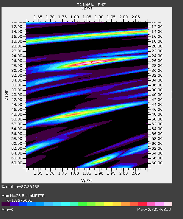
Signal To Noise
| Channel | StoN | STA | LTA |
| TA:N46A: :BHZ:20120810T18:46:33.649998Z | 3.1065426 | 4.289008E-7 | 1.380637E-7 |
| TA:N46A: :BHN:20120810T18:46:33.649998Z | 1.9490532 | 3.1953644E-7 | 1.6394445E-7 |
| TA:N46A: :BHE:20120810T18:46:33.649998Z | 1.1601155 | 2.0685872E-7 | 1.7830872E-7 |
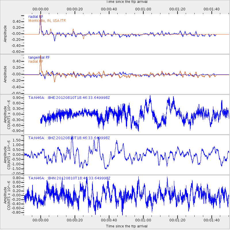
| Arrivals | |
| Ps | 3.7 SECOND |
| PpPs | 11 SECOND |
| PsPs/PpSs | 15 SECOND |

