
O45A Potomac, IL, USA - Earthquake Result Viewer
| ||||||||||||||||||
| ||||||||||||||||||
| ||||||||||||||||||
|
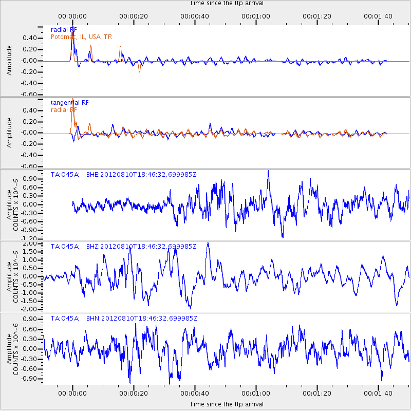
Signal To Noise
| Channel | StoN | STA | LTA |
| TA:O45A: :BHZ:20120810T18:46:32.699985Z | 2.7116013 | 5.0854595E-7 | 1.8754452E-7 |
| TA:O45A: :BHN:20120810T18:46:32.699985Z | 1.3947408 | 2.771806E-7 | 1.9873269E-7 |
| TA:O45A: :BHE:20120810T18:46:32.699985Z | 2.6387336 | 2.9333847E-7 | 1.11166386E-7 |
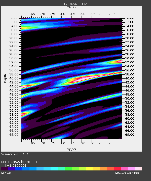
| Arrivals | |
| Ps | 5.9 SECOND |
| PpPs | 17 SECOND |
| PsPs/PpSs | 23 SECOND |

