P46A Rosedale, IN, USA - Earthquake Result Viewer
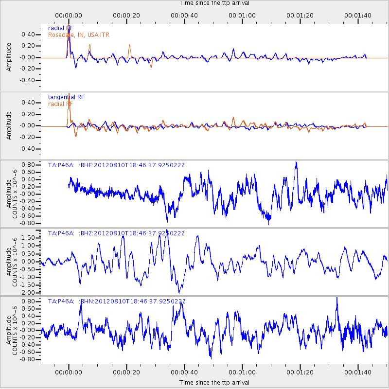
Earthquake location: Fox Islands, Aleutian Islands
Earthquake latitude/longitude: 52.6/-167.4
Earthquake time(UTC): 2012/08/10 (223) 18:37:43 GMT
Earthquake Depth: 13 km
Earthquake Magnitude: 5.9 MB, 6.2 MS, 6.2 MW, 6.2 MW
Earthquake Catalog/Contributor: WHDF/NEIC
Network: TA USArray Transportable Network (new EarthScope stations)
Station: P46A Rosedale, IN, USA
Lat/Lon: 39.62 N/87.21 W
Elevation: 194 m
Distance: 54.3 deg
Az: 69.604 deg
Baz: 312.302 deg
Ray Param: 0.06552682
Estimated Moho Depth: 12.0 km
Estimated Crust Vp/Vs: 1.72
Assumed Crust Vp: 6.444 km/s
Estimated Crust Vs: 3.752 km/s
Estimated Crust Poisson's Ratio: 0.24
Radial Match: 81.875565 %
Radial Bump: 400
Transverse Match: 57.360413 %
Transverse Bump: 400
SOD ConfigId: 469095
Insert Time: 2013-02-22 06:07:13.183 +0000
GWidth: 2.5
Max Bumps: 400
Tol: 0.001

Signal To Noise

ChannelStoNSTALTA
TA:P46A: :BHZ:20120810T18:46:37.925022Z4.74193055.3617725E-71.1307151E-7
TA:P46A: :BHN:20120810T18:46:37.925022Z2.02378823.037717E-71.5010055E-7
TA:P46A: :BHE:20120810T18:46:37.925022Z2.92784863.468657E-71.1847119E-7
Arrivals
Ps1.4 SECOND
PpPs4.8 SECOND
PsPs/PpSs6.2 SECOND