T47A Sharon Grove, KY, USA - Earthquake Result Viewer
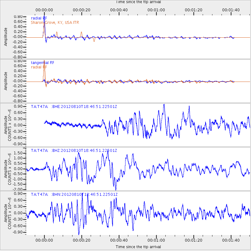
Earthquake location: Fox Islands, Aleutian Islands
Earthquake latitude/longitude: 52.6/-167.4
Earthquake time(UTC): 2012/08/10 (223) 18:37:43 GMT
Earthquake Depth: 13 km
Earthquake Magnitude: 5.9 MB, 6.2 MS, 6.2 MW, 6.2 MW
Earthquake Catalog/Contributor: WHDF/NEIC
Network: TA USArray Transportable Network (new EarthScope stations)
Station: T47A Sharon Grove, KY, USA
Lat/Lon: 36.99 N/87.11 W
Elevation: 217 m
Distance: 56.1 deg
Az: 71.876 deg
Baz: 313.661 deg
Ray Param: 0.06432303
Estimated Moho Depth: 37.25 km
Estimated Crust Vp/Vs: 1.92
Assumed Crust Vp: 6.444 km/s
Estimated Crust Vs: 3.356 km/s
Estimated Crust Poisson's Ratio: 0.31
Radial Match: 94.37252 %
Radial Bump: 387
Transverse Match: 79.39141 %
Transverse Bump: 400
SOD ConfigId: 469095
Insert Time: 2013-02-22 06:08:13.986 +0000
GWidth: 2.5
Max Bumps: 400
Tol: 0.001

Signal To Noise

ChannelStoNSTALTA
TA:T47A: :BHZ:20120810T18:46:51.22501Z6.772494.1420415E-76.11598E-8
TA:T47A: :BHN:20120810T18:46:51.22501Z2.33902172.0576508E-78.797057E-8
TA:T47A: :BHE:20120810T18:46:51.22501Z3.1866342.1972298E-76.895144E-8
Arrivals
Ps5.6 SECOND
PpPs16 SECOND
PsPs/PpSs22 SECOND