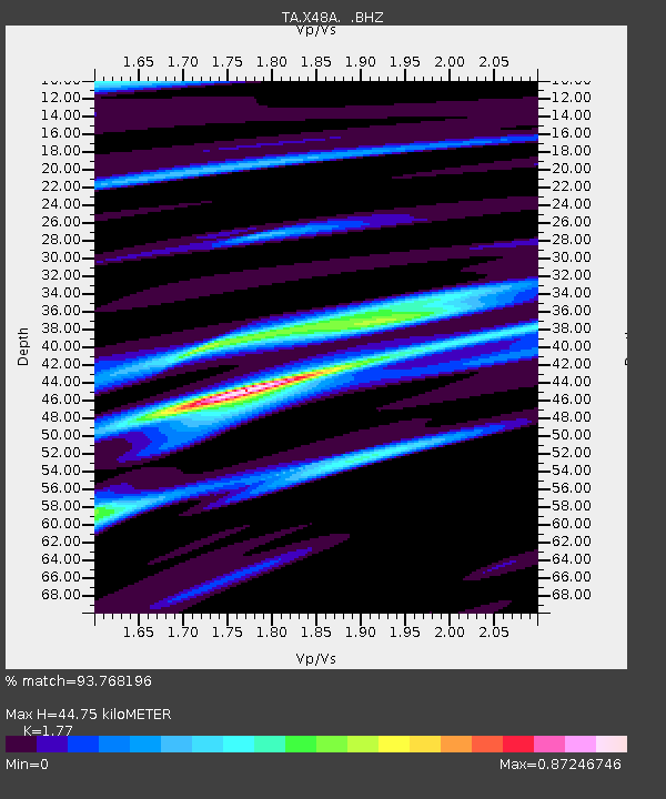
X48A Hartselle, AL, USA - Earthquake Result Viewer
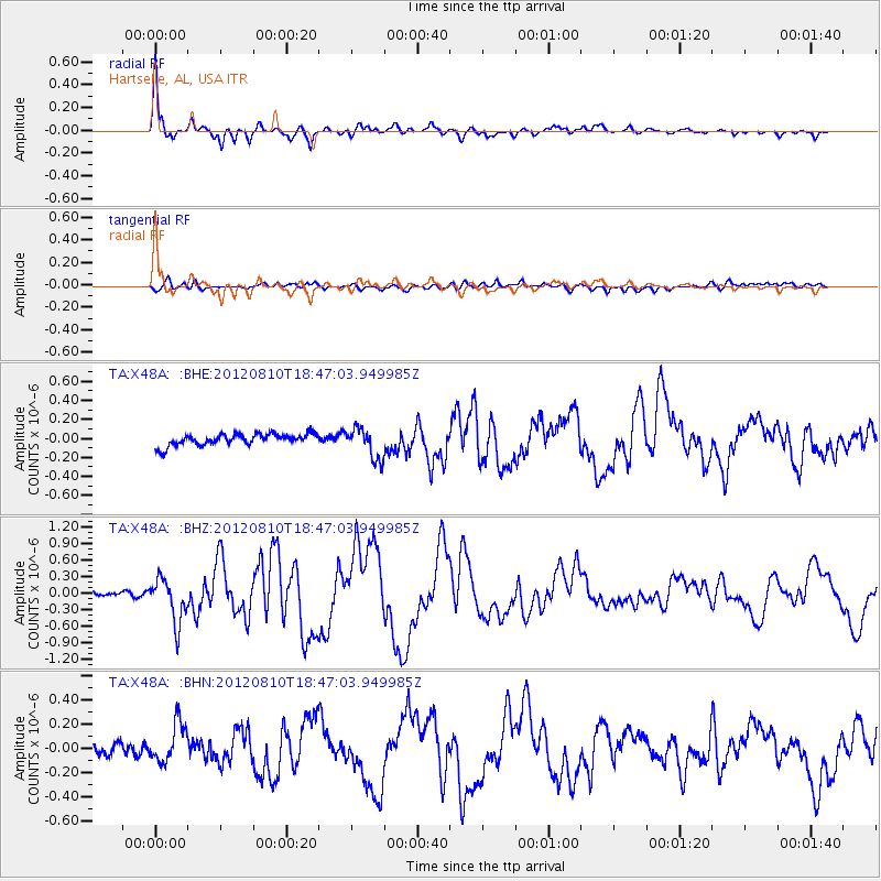
Earthquake location: Fox Islands, Aleutian Islands
Earthquake latitude/longitude: 52.6/-167.4
Earthquake time(UTC): 2012/08/10 (223) 18:37:43 GMT
Earthquake Depth: 13 km
Earthquake Magnitude: 5.9 MB, 6.2 MS, 6.2 MW, 6.2 MW
Earthquake Catalog/Contributor: WHDF/NEIC
Network: TA USArray Transportable Network (new EarthScope stations)
Station: X48A Hartselle, AL, USA
Lat/Lon: 34.45 N/87.05 W
Elevation: 180 m
Distance: 58.0 deg
Az: 73.995 deg
Baz: 314.849 deg
Ray Param: 0.06315517
Estimated Moho Depth: 44.75 km
Estimated Crust Vp/Vs: 1.77
Assumed Crust Vp: 6.476 km/s
Estimated Crust Vs: 3.659 km/s
Estimated Crust Poisson's Ratio: 0.27
Radial Match: 93.768196 %
Radial Bump: 400
Transverse Match: 72.50936 %
Transverse Bump: 400
SOD ConfigId: 469095
Insert Time: 2013-02-22 06:09:11.559 +0000
GWidth: 2.5
Max Bumps: 400
Tol: 0.001

Signal To Noise

ChannelStoNSTALTA
TA:X48A: :BHZ:20120810T18:47:03.949985Z7.97686153.9553953E-74.9585857E-8
TA:X48A: :BHN:20120810T18:47:03.949985Z3.60881351.6497759E-74.5715186E-8
TA:X48A: :BHE:20120810T18:47:03.949985Z2.70433881.6228611E-76.000953E-8
Arrivals
Ps5.6 SECOND
PpPs18 SECOND
PsPs/PpSs24 SECOND