Y48A Jasper, AL, USA - Earthquake Result Viewer
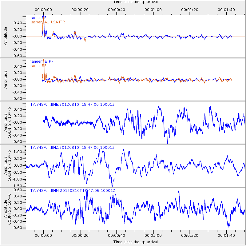
Earthquake location: Fox Islands, Aleutian Islands
Earthquake latitude/longitude: 52.6/-167.4
Earthquake time(UTC): 2012/08/10 (223) 18:37:43 GMT
Earthquake Depth: 13 km
Earthquake Magnitude: 5.9 MB, 6.2 MS, 6.2 MW, 6.2 MW
Earthquake Catalog/Contributor: WHDF/NEIC
Network: TA USArray Transportable Network (new EarthScope stations)
Station: Y48A Jasper, AL, USA
Lat/Lon: 33.91 N/87.17 W
Elevation: 170 m
Distance: 58.3 deg
Az: 74.529 deg
Baz: 315.062 deg
Ray Param: 0.062955305
Estimated Moho Depth: 41.25 km
Estimated Crust Vp/Vs: 1.89
Assumed Crust Vp: 6.565 km/s
Estimated Crust Vs: 3.478 km/s
Estimated Crust Poisson's Ratio: 0.30
Radial Match: 89.69798 %
Radial Bump: 400
Transverse Match: 52.375923 %
Transverse Bump: 400
SOD ConfigId: 469095
Insert Time: 2013-02-22 06:09:23.908 +0000
GWidth: 2.5
Max Bumps: 400
Tol: 0.001

Signal To Noise

ChannelStoNSTALTA
TA:Y48A: :BHZ:20120810T18:47:06.10001Z4.83189773.9656123E-78.207153E-8
TA:Y48A: :BHN:20120810T18:47:06.10001Z2.0315221.311384E-76.4551806E-8
TA:Y48A: :BHE:20120810T18:47:06.10001Z2.30272361.4844193E-76.4463634E-8
Arrivals
Ps5.9 SECOND
PpPs17 SECOND
PsPs/PpSs23 SECOND