Z50A Ashland, AL, USA - Earthquake Result Viewer
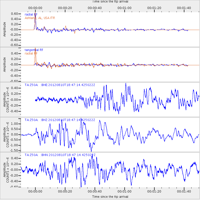
Earthquake location: Fox Islands, Aleutian Islands
Earthquake latitude/longitude: 52.6/-167.4
Earthquake time(UTC): 2012/08/10 (223) 18:37:43 GMT
Earthquake Depth: 13 km
Earthquake Magnitude: 5.9 MB, 6.2 MS, 6.2 MW, 6.2 MW
Earthquake Catalog/Contributor: WHDF/NEIC
Network: TA USArray Transportable Network (new EarthScope stations)
Station: Z50A Ashland, AL, USA
Lat/Lon: 33.25 N/85.92 W
Elevation: 370 m
Distance: 59.5 deg
Az: 74.204 deg
Baz: 315.58 deg
Ray Param: 0.06216914
Estimated Moho Depth: 50.25 km
Estimated Crust Vp/Vs: 1.80
Assumed Crust Vp: 6.719 km/s
Estimated Crust Vs: 3.733 km/s
Estimated Crust Poisson's Ratio: 0.28
Radial Match: 95.532135 %
Radial Bump: 400
Transverse Match: 76.404236 %
Transverse Bump: 400
SOD ConfigId: 469095
Insert Time: 2013-02-22 06:09:45.343 +0000
GWidth: 2.5
Max Bumps: 400
Tol: 0.001

Signal To Noise

ChannelStoNSTALTA
TA:Z50A: :BHZ:20120810T18:47:14.425022Z8.0462924.082381E-75.0736176E-8
TA:Z50A: :BHN:20120810T18:47:14.425022Z2.11289381.28196E-76.067319E-8
TA:Z50A: :BHE:20120810T18:47:14.425022Z2.71195241.1522428E-74.248757E-8
Arrivals
Ps6.3 SECOND
PpPs20 SECOND
PsPs/PpSs26 SECOND