V46A Holladay, TN, USA - Earthquake Result Viewer
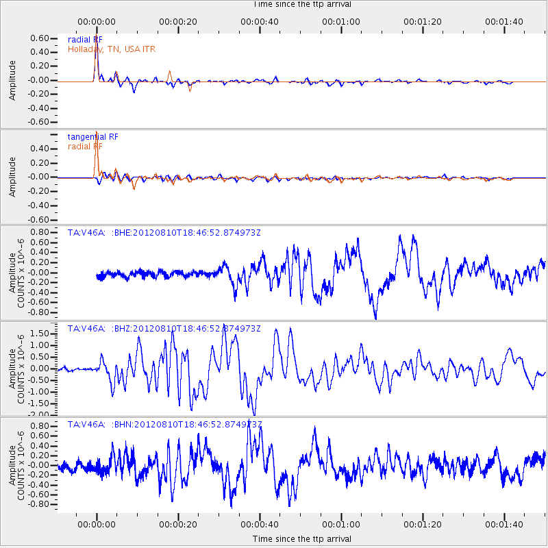
Earthquake location: Fox Islands, Aleutian Islands
Earthquake latitude/longitude: 52.6/-167.4
Earthquake time(UTC): 2012/08/10 (223) 18:37:43 GMT
Earthquake Depth: 13 km
Earthquake Magnitude: 5.9 MB, 6.2 MS, 6.2 MW, 6.2 MW
Earthquake Catalog/Contributor: WHDF/NEIC
Network: TA USArray Transportable Network (new EarthScope stations)
Station: V46A Holladay, TN, USA
Lat/Lon: 35.80 N/88.12 W
Elevation: 162 m
Distance: 56.4 deg
Az: 73.584 deg
Baz: 314.012 deg
Ray Param: 0.06417221
Estimated Moho Depth: 34.0 km
Estimated Crust Vp/Vs: 1.83
Assumed Crust Vp: 6.38 km/s
Estimated Crust Vs: 3.487 km/s
Estimated Crust Poisson's Ratio: 0.29
Radial Match: 97.76664 %
Radial Bump: 325
Transverse Match: 85.01698 %
Transverse Bump: 400
SOD ConfigId: 469095
Insert Time: 2013-02-22 06:09:56.101 +0000
GWidth: 2.5
Max Bumps: 400
Tol: 0.001

Signal To Noise

ChannelStoNSTALTA
TA:V46A: :BHZ:20120810T18:46:52.874973Z6.34305434.5788428E-77.218672E-8
TA:V46A: :BHN:20120810T18:46:52.874973Z2.09730241.6651313E-77.939395E-8
TA:V46A: :BHE:20120810T18:46:52.874973Z3.80264741.9275204E-75.0688907E-8
Arrivals
Ps4.6 SECOND
PpPs14 SECOND
PsPs/PpSs19 SECOND