W46A Michie, TN, USA - Earthquake Result Viewer
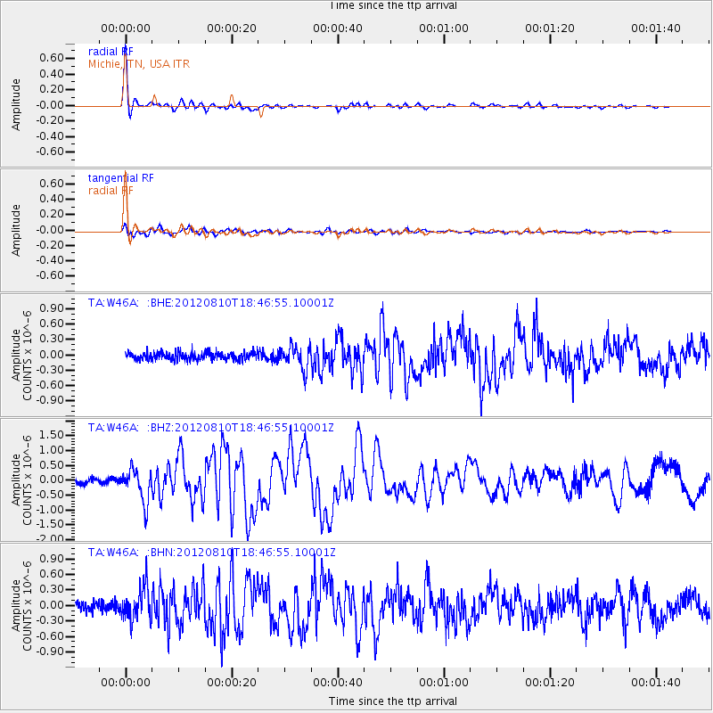
Earthquake location: Fox Islands, Aleutian Islands
Earthquake latitude/longitude: 52.6/-167.4
Earthquake time(UTC): 2012/08/10 (223) 18:37:43 GMT
Earthquake Depth: 13 km
Earthquake Magnitude: 5.9 MB, 6.2 MS, 6.2 MW, 6.2 MW
Earthquake Catalog/Contributor: WHDF/NEIC
Network: TA USArray Transportable Network (new EarthScope stations)
Station: W46A Michie, TN, USA
Lat/Lon: 35.13 N/88.38 W
Elevation: 145 m
Distance: 56.7 deg
Az: 74.335 deg
Baz: 314.275 deg
Ray Param: 0.06396879
Estimated Moho Depth: 19.5 km
Estimated Crust Vp/Vs: 1.60
Assumed Crust Vp: 6.38 km/s
Estimated Crust Vs: 3.988 km/s
Estimated Crust Poisson's Ratio: 0.18
Radial Match: 97.33476 %
Radial Bump: 315
Transverse Match: 86.36213 %
Transverse Bump: 400
SOD ConfigId: 469095
Insert Time: 2013-02-22 06:09:56.963 +0000
GWidth: 2.5
Max Bumps: 400
Tol: 0.001

Signal To Noise

ChannelStoNSTALTA
TA:W46A: :BHZ:20120810T18:46:55.10001Z6.0629715.608482E-79.250386E-8
TA:W46A: :BHN:20120810T18:46:55.10001Z4.0702243.2218372E-77.9156266E-8
TA:W46A: :BHE:20120810T18:46:55.10001Z2.93580562.2134073E-77.539353E-8
Arrivals
Ps1.9 SECOND
PpPs7.5 SECOND
PsPs/PpSs9.5 SECOND