W48A Pulaski, TN, USA - Earthquake Result Viewer
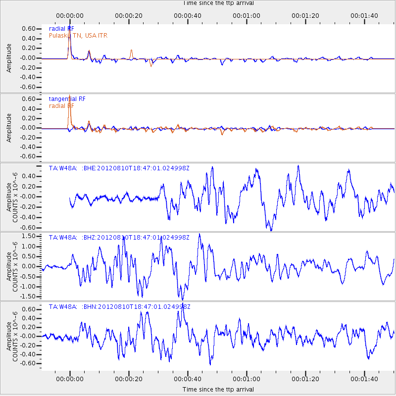
Earthquake location: Fox Islands, Aleutian Islands
Earthquake latitude/longitude: 52.6/-167.4
Earthquake time(UTC): 2012/08/10 (223) 18:37:43 GMT
Earthquake Depth: 13 km
Earthquake Magnitude: 5.9 MB, 6.2 MS, 6.2 MW, 6.2 MW
Earthquake Catalog/Contributor: WHDF/NEIC
Network: TA USArray Transportable Network (new EarthScope stations)
Station: W48A Pulaski, TN, USA
Lat/Lon: 35.14 N/86.93 W
Elevation: 260 m
Distance: 57.5 deg
Az: 73.343 deg
Baz: 314.564 deg
Ray Param: 0.063422695
Estimated Moho Depth: 54.5 km
Estimated Crust Vp/Vs: 1.74
Assumed Crust Vp: 6.476 km/s
Estimated Crust Vs: 3.722 km/s
Estimated Crust Poisson's Ratio: 0.25
Radial Match: 97.05489 %
Radial Bump: 269
Transverse Match: 76.21247 %
Transverse Bump: 400
SOD ConfigId: 469095
Insert Time: 2013-02-22 06:10:06.095 +0000
GWidth: 2.5
Max Bumps: 400
Tol: 0.001

Signal To Noise

ChannelStoNSTALTA
TA:W48A: :BHZ:20120810T18:47:01.024998Z5.29437644.117315E-77.77677E-8
TA:W48A: :BHN:20120810T18:47:01.024998Z3.3490731.2579018E-73.75597E-8
TA:W48A: :BHE:20120810T18:47:01.024998Z3.413561.9065298E-75.5851658E-8
Arrivals
Ps6.6 SECOND
PpPs22 SECOND
PsPs/PpSs28 SECOND