
151A Opelika, AL, USA - Earthquake Result Viewer
| ||||||||||||||||||
| ||||||||||||||||||
| ||||||||||||||||||
|
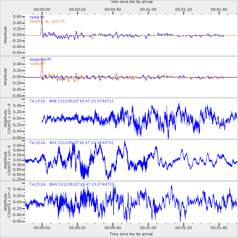
Signal To Noise
| Channel | StoN | STA | LTA |
| TA:151A: :BHZ:20120810T18:47:20.374973Z | 4.837367 | 3.3568327E-7 | 6.939379E-8 |
| TA:151A: :BHN:20120810T18:47:20.374973Z | 1.8060275 | 1.1968032E-7 | 6.626716E-8 |
| TA:151A: :BHE:20120810T18:47:20.374973Z | 1.9362714 | 1.1942181E-7 | 6.1676175E-8 |
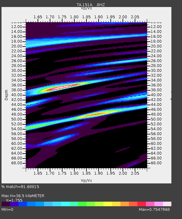
| Arrivals | |
| Ps | 4.3 SECOND |
| PpPs | 14 SECOND |
| PsPs/PpSs | 19 SECOND |

