You are here: Home > Network List > TA - USArray Transportable Network (new EarthScope stations) Stations List
> Station 453A Whigham, GA, USA > Earthquake Result Viewer
453A Whigham, GA, USA - Earthquake Result Viewer
*The percent match for this event was below the threshold and hence no stack was calculated.
| Earthquake location: |
Fox Islands, Aleutian Islands |
| Earthquake latitude/longitude: |
52.6/-167.4 |
| Earthquake time(UTC): |
2012/08/10 (223) 18:37:43 GMT |
| Earthquake Depth: |
13 km |
| Earthquake Magnitude: |
5.9 MB, 6.2 MS, 6.2 MW, 6.2 MW |
| Earthquake Catalog/Contributor: |
WHDF/NEIC |
|
| Network: |
TA USArray Transportable Network (new EarthScope stations) |
| Station: |
453A Whigham, GA, USA |
| Lat/Lon: |
30.85 N/84.32 W |
| Elevation: |
82 m |
|
| Distance: |
62.1 deg |
| Az: |
74.976 deg |
| Baz: |
316.804 deg |
| Ray Param: |
$rayparam |
*The percent match for this event was below the threshold and hence was not used in the summary stack. |
|
| Radial Match: |
82.80559 % |
| Radial Bump: |
400 |
| Transverse Match: |
57.001896 % |
| Transverse Bump: |
400 |
| SOD ConfigId: |
469095 |
| Insert Time: |
2013-02-22 06:11:09.026 +0000 |
| GWidth: |
2.5 |
| Max Bumps: |
400 |
| Tol: |
0.001 |
|
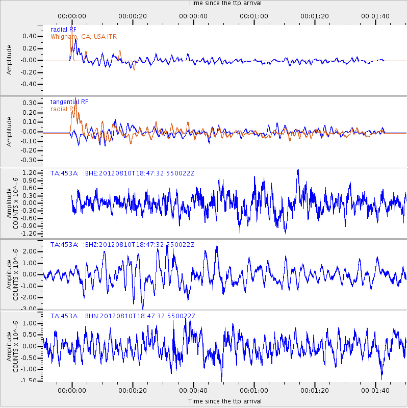
Signal To Noise
| Channel | StoN | STA | LTA |
| TA:453A: :BHZ:20120810T18:47:32.550022Z | 2.5309455 | 7.4203166E-7 | 2.9318358E-7 |
| TA:453A: :BHN:20120810T18:47:32.550022Z | 1.5465128 | 3.7700727E-7 | 2.4377894E-7 |
| TA:453A: :BHE:20120810T18:47:32.550022Z | 1.37452 | 3.0123195E-7 | 2.191543E-7 |
| Arrivals |
| Ps | |
| PpPs | |
| PsPs/PpSs | |


