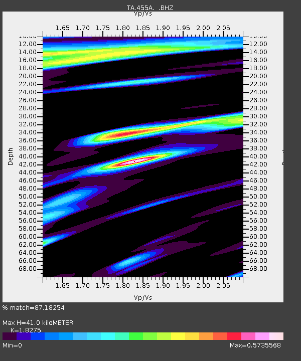
455A Stateville, GA, USA - Earthquake Result Viewer
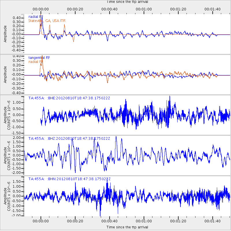
Earthquake location: Fox Islands, Aleutian Islands
Earthquake latitude/longitude: 52.6/-167.4
Earthquake time(UTC): 2012/08/10 (223) 18:37:43 GMT
Earthquake Depth: 13 km
Earthquake Magnitude: 5.9 MB, 6.2 MS, 6.2 MW, 6.2 MW
Earthquake Catalog/Contributor: WHDF/NEIC
Network: TA USArray Transportable Network (new EarthScope stations)
Station: 455A Stateville, GA, USA
Lat/Lon: 30.74 N/83.03 W
Elevation: 44 m
Distance: 63.0 deg
Az: 74.146 deg
Baz: 317.08 deg
Ray Param: 0.059875347
Estimated Moho Depth: 41.0 km
Estimated Crust Vp/Vs: 1.83
Assumed Crust Vp: 6.565 km/s
Estimated Crust Vs: 3.592 km/s
Estimated Crust Poisson's Ratio: 0.29
Radial Match: 87.18254 %
Radial Bump: 400
Transverse Match: 47.11049 %
Transverse Bump: 400
SOD ConfigId: 469095
Insert Time: 2013-02-22 06:11:16.591 +0000
GWidth: 2.5
Max Bumps: 400
Tol: 0.001

Signal To Noise

ChannelStoNSTALTA
TA:455A: :BHZ:20120810T18:47:38.175022Z2.16123445.2326004E-72.4211167E-7
TA:455A: :BHN:20120810T18:47:38.175022Z1.51316273.0343685E-72.0053153E-7
TA:455A: :BHE:20120810T18:47:38.175022Z1.33608023.592584E-72.6888983E-7
Arrivals
Ps5.4 SECOND
PpPs17 SECOND
PsPs/PpSs22 SECOND