454A Quitman, GA, USA - Earthquake Result Viewer
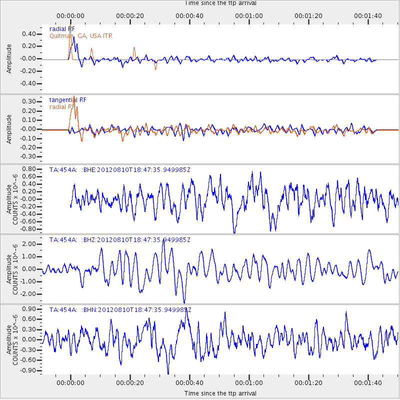
Earthquake location: Fox Islands, Aleutian Islands
Earthquake latitude/longitude: 52.6/-167.4
Earthquake time(UTC): 2012/08/10 (223) 18:37:43 GMT
Earthquake Depth: 13 km
Earthquake Magnitude: 5.9 MB, 6.2 MS, 6.2 MW, 6.2 MW
Earthquake Catalog/Contributor: WHDF/NEIC
Network: TA USArray Transportable Network (new EarthScope stations)
Station: 454A Quitman, GA, USA
Lat/Lon: 30.71 N/83.63 W
Elevation: 50 m
Distance: 62.6 deg
Az: 74.595 deg
Baz: 316.978 deg
Ray Param: 0.060091875
Estimated Moho Depth: 15.25 km
Estimated Crust Vp/Vs: 1.90
Assumed Crust Vp: 6.565 km/s
Estimated Crust Vs: 3.455 km/s
Estimated Crust Poisson's Ratio: 0.31
Radial Match: 84.21021 %
Radial Bump: 400
Transverse Match: 51.97574 %
Transverse Bump: 400
SOD ConfigId: 469095
Insert Time: 2013-02-22 06:11:20.846 +0000
GWidth: 2.5
Max Bumps: 400
Tol: 0.001

Signal To Noise

ChannelStoNSTALTA
TA:454A: :BHZ:20120810T18:47:35.949985Z2.07670195.5274893E-72.661667E-7
TA:454A: :BHN:20120810T18:47:35.949985Z1.18179012.3415826E-71.9813862E-7
TA:454A: :BHE:20120810T18:47:35.949985Z1.46850382.705051E-71.8420455E-7
Arrivals
Ps2.2 SECOND
PpPs6.5 SECOND
PsPs/PpSs8.6 SECOND