
352A Blakely, GA, USA - Earthquake Result Viewer
| ||||||||||||||||||
| ||||||||||||||||||
| ||||||||||||||||||
|
Signal To Noise
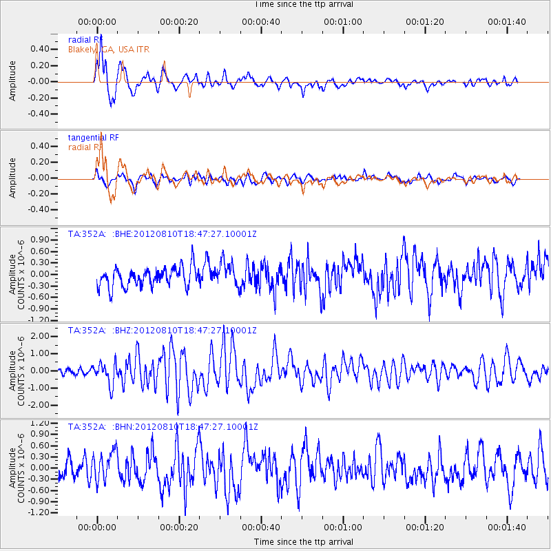
| Channel | StoN | STA | LTA |
| TA:352A: :BHZ:20120810T18:47:27.10001Z | 3.6002724 | 6.537501E-7 | 1.8158352E-7 |
| TA:352A: :BHN:20120810T18:47:27.10001Z | 1.6365273 | 3.903981E-7 | 2.3855276E-7 |
| TA:352A: :BHE:20120810T18:47:27.10001Z | 1.3248279 | 3.2791257E-7 | 2.4751333E-7 |
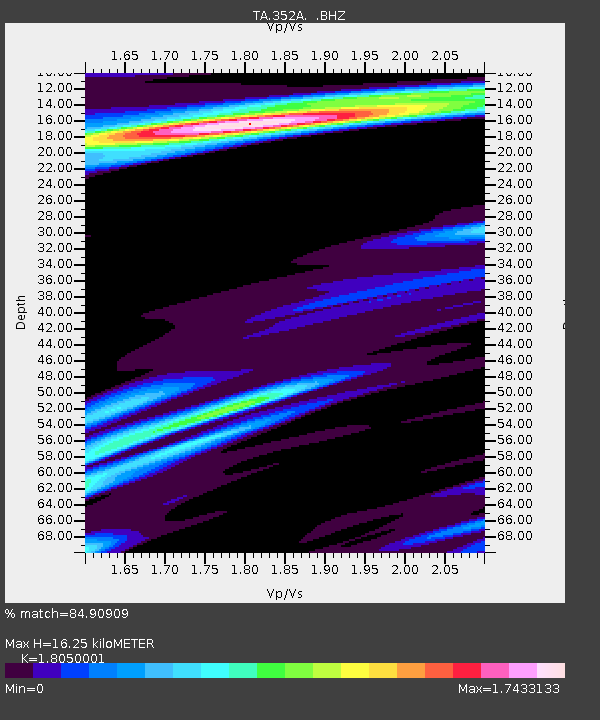
| Arrivals | |
| Ps | 2.2 SECOND |
| PpPs | 6.9 SECOND |
| PsPs/PpSs | 9.0 SECOND |

