X51A Calhoun, GA, USA - Earthquake Result Viewer
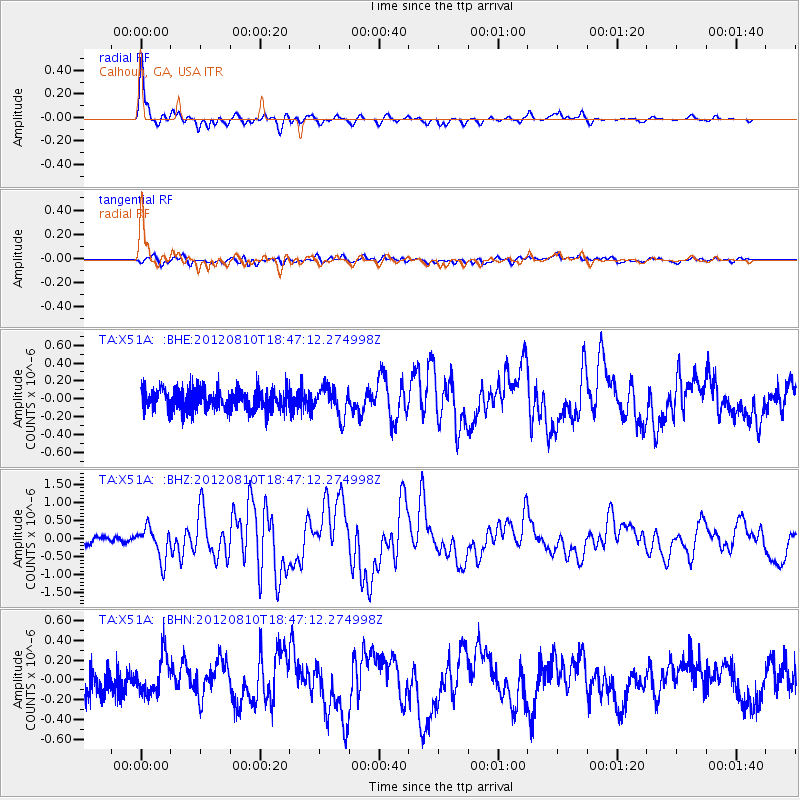
Earthquake location: Fox Islands, Aleutian Islands
Earthquake latitude/longitude: 52.6/-167.4
Earthquake time(UTC): 2012/08/10 (223) 18:37:43 GMT
Earthquake Depth: 13 km
Earthquake Magnitude: 5.9 MB, 6.2 MS, 6.2 MW, 6.2 MW
Earthquake Catalog/Contributor: WHDF/NEIC
Network: TA USArray Transportable Network (new EarthScope stations)
Station: X51A Calhoun, GA, USA
Lat/Lon: 34.57 N/84.86 W
Elevation: 214 m
Distance: 59.1 deg
Az: 72.402 deg
Baz: 315.252 deg
Ray Param: 0.062374286
Estimated Moho Depth: 43.75 km
Estimated Crust Vp/Vs: 1.76
Assumed Crust Vp: 6.35 km/s
Estimated Crust Vs: 3.613 km/s
Estimated Crust Poisson's Ratio: 0.26
Radial Match: 95.1897 %
Radial Bump: 400
Transverse Match: 52.508022 %
Transverse Bump: 400
SOD ConfigId: 469095
Insert Time: 2013-02-22 06:12:41.426 +0000
GWidth: 2.5
Max Bumps: 400
Tol: 0.001

Signal To Noise

ChannelStoNSTALTA
TA:X51A: :BHZ:20120810T18:47:12.274998Z4.16778044.4361653E-71.0643952E-7
TA:X51A: :BHN:20120810T18:47:12.274998Z1.59963981.8971105E-71.185961E-7
TA:X51A: :BHE:20120810T18:47:12.274998Z1.36413681.5914667E-71.1666474E-7
Arrivals
Ps5.5 SECOND
PpPs18 SECOND
PsPs/PpSs24 SECOND