Z51A Franklin, GA, USA - Earthquake Result Viewer
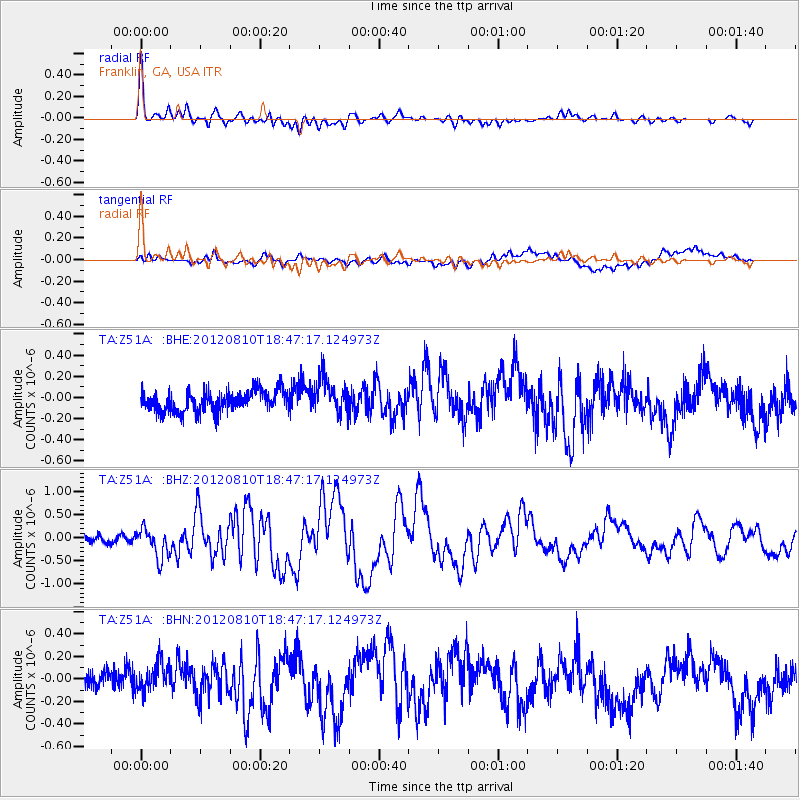
Earthquake location: Fox Islands, Aleutian Islands
Earthquake latitude/longitude: 52.6/-167.4
Earthquake time(UTC): 2012/08/10 (223) 18:37:43 GMT
Earthquake Depth: 13 km
Earthquake Magnitude: 5.9 MB, 6.2 MS, 6.2 MW, 6.2 MW
Earthquake Catalog/Contributor: WHDF/NEIC
Network: TA USArray Transportable Network (new EarthScope stations)
Station: Z51A Franklin, GA, USA
Lat/Lon: 33.32 N/85.17 W
Elevation: 249 m
Distance: 59.8 deg
Az: 73.635 deg
Baz: 315.701 deg
Ray Param: 0.061911236
Estimated Moho Depth: 43.75 km
Estimated Crust Vp/Vs: 1.68
Assumed Crust Vp: 6.719 km/s
Estimated Crust Vs: 4.012 km/s
Estimated Crust Poisson's Ratio: 0.22
Radial Match: 82.78709 %
Radial Bump: 400
Transverse Match: 54.296276 %
Transverse Bump: 400
SOD ConfigId: 469095
Insert Time: 2013-02-22 06:12:57.102 +0000
GWidth: 2.5
Max Bumps: 400
Tol: 0.001

Signal To Noise

ChannelStoNSTALTA
TA:Z51A: :BHZ:20120810T18:47:17.124973Z3.9108423.131927E-78.008319E-8
TA:Z51A: :BHN:20120810T18:47:17.124973Z0.897184971.2373094E-71.3791018E-7
TA:Z51A: :BHE:20120810T18:47:17.124973Z1.73616351.7104321E-79.8517916E-8
Arrivals
Ps4.6 SECOND
PpPs16 SECOND
PsPs/PpSs21 SECOND