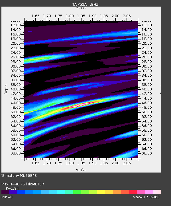
Y52A Lilburn, GA, USA - Earthquake Result Viewer
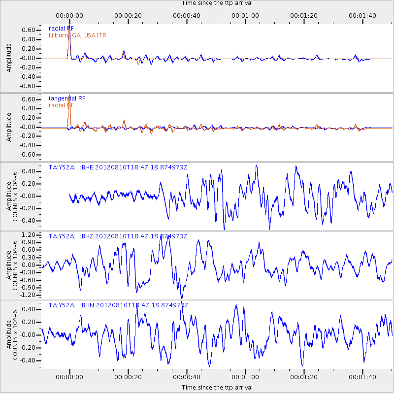
Earthquake location: Fox Islands, Aleutian Islands
Earthquake latitude/longitude: 52.6/-167.4
Earthquake time(UTC): 2012/08/10 (223) 18:37:43 GMT
Earthquake Depth: 13 km
Earthquake Magnitude: 5.9 MB, 6.2 MS, 6.2 MW, 6.2 MW
Earthquake Catalog/Contributor: WHDF/NEIC
Network: TA USArray Transportable Network (new EarthScope stations)
Station: Y52A Lilburn, GA, USA
Lat/Lon: 33.86 N/84.06 W
Elevation: 286 m
Distance: 60.1 deg
Az: 72.427 deg
Baz: 315.709 deg
Ray Param: 0.06174322
Estimated Moho Depth: 46.75 km
Estimated Crust Vp/Vs: 1.84
Assumed Crust Vp: 6.719 km/s
Estimated Crust Vs: 3.652 km/s
Estimated Crust Poisson's Ratio: 0.29
Radial Match: 95.76843 %
Radial Bump: 283
Transverse Match: 62.044106 %
Transverse Bump: 400
SOD ConfigId: 469095
Insert Time: 2013-02-22 06:13:02.734 +0000
GWidth: 2.5
Max Bumps: 400
Tol: 0.001

Signal To Noise

ChannelStoNSTALTA
TA:Y52A: :BHZ:20120810T18:47:18.874973Z4.27091844.0360396E-79.4500514E-8
TA:Y52A: :BHN:20120810T18:47:18.874973Z2.27299761.3066743E-75.7486826E-8
TA:Y52A: :BHE:20120810T18:47:18.874973Z3.00867031.5594024E-75.1830284E-8
Arrivals
Ps6.1 SECOND
PpPs19 SECOND
PsPs/PpSs25 SECOND