Y54A Tignall, GA, USA - Earthquake Result Viewer
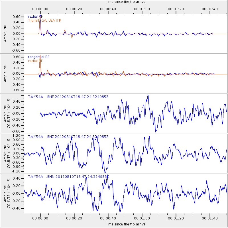
Earthquake location: Fox Islands, Aleutian Islands
Earthquake latitude/longitude: 52.6/-167.4
Earthquake time(UTC): 2012/08/10 (223) 18:37:43 GMT
Earthquake Depth: 13 km
Earthquake Magnitude: 5.9 MB, 6.2 MS, 6.2 MW, 6.2 MW
Earthquake Catalog/Contributor: WHDF/NEIC
Network: TA USArray Transportable Network (new EarthScope stations)
Station: Y54A Tignall, GA, USA
Lat/Lon: 33.86 N/82.69 W
Elevation: 176 m
Distance: 60.9 deg
Az: 71.485 deg
Baz: 316.008 deg
Ray Param: 0.061216515
Estimated Moho Depth: 67.0 km
Estimated Crust Vp/Vs: 1.69
Assumed Crust Vp: 6.565 km/s
Estimated Crust Vs: 3.89 km/s
Estimated Crust Poisson's Ratio: 0.23
Radial Match: 95.19643 %
Radial Bump: 332
Transverse Match: 61.65112 %
Transverse Bump: 400
SOD ConfigId: 469095
Insert Time: 2013-02-22 06:13:13.508 +0000
GWidth: 2.5
Max Bumps: 400
Tol: 0.001

Signal To Noise

ChannelStoNSTALTA
TA:Y54A: :BHZ:20120810T18:47:24.324985Z5.8103533.3243748E-75.7214685E-8
TA:Y54A: :BHN:20120810T18:47:24.324985Z2.4973841.238775E-74.9602903E-8
TA:Y54A: :BHE:20120810T18:47:24.324985Z3.08793041.5812813E-75.120845E-8
Arrivals
Ps7.4 SECOND
PpPs26 SECOND
PsPs/PpSs33 SECOND