
Y53A Monroe, GA, USA - Earthquake Result Viewer
| ||||||||||||||||||
| ||||||||||||||||||
| ||||||||||||||||||
|
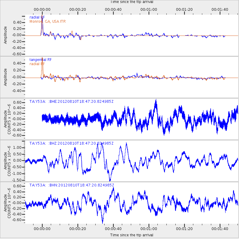
Signal To Noise
| Channel | StoN | STA | LTA |
| TA:Y53A: :BHZ:20120810T18:47:20.824985Z | 4.1405177 | 3.6174475E-7 | 8.736704E-8 |
| TA:Y53A: :BHN:20120810T18:47:20.824985Z | 1.68686 | 1.4006697E-7 | 8.303414E-8 |
| TA:Y53A: :BHE:20120810T18:47:20.824985Z | 1.5132725 | 1.6206793E-7 | 1.0709765E-7 |
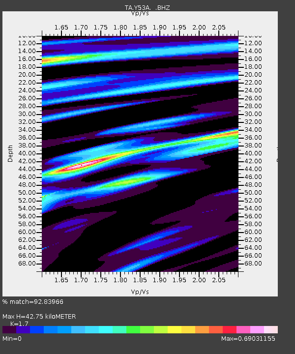
| Arrivals | |
| Ps | 4.8 SECOND |
| PpPs | 17 SECOND |
| PsPs/PpSs | 22 SECOND |

