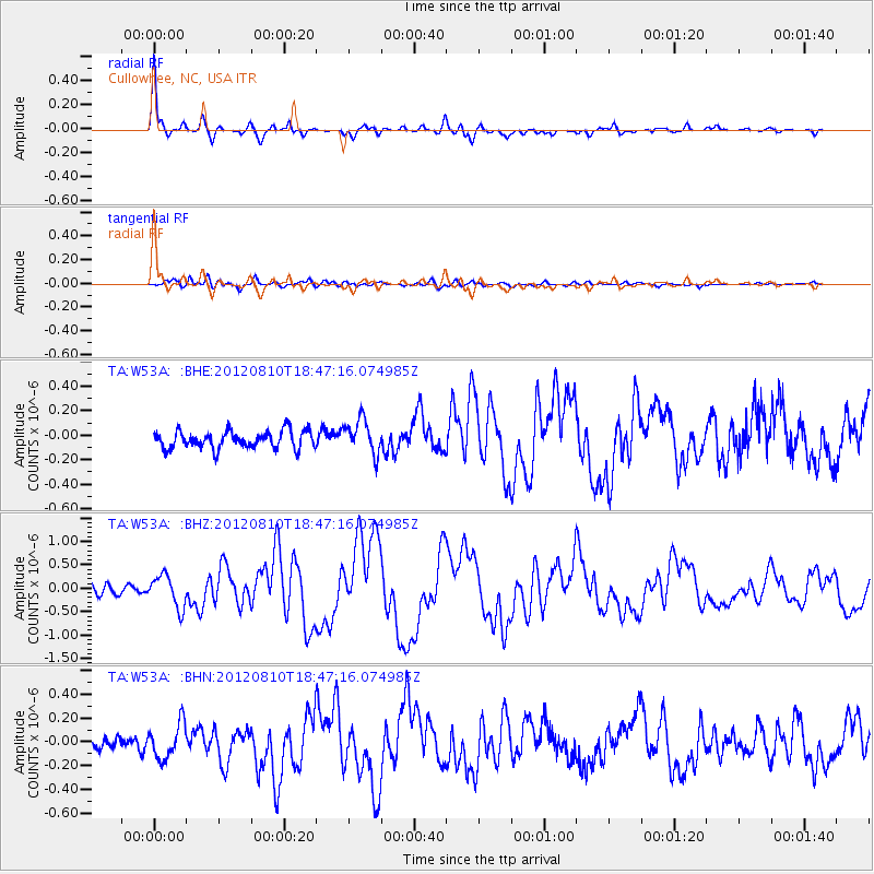
W53A Cullowhee, NC, USA - Earthquake Result Viewer
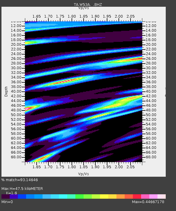
Earthquake location: Fox Islands, Aleutian Islands
Earthquake latitude/longitude: 52.6/-167.4
Earthquake time(UTC): 2012/08/10 (223) 18:37:43 GMT
Earthquake Depth: 13 km
Earthquake Magnitude: 5.9 MB, 6.2 MS, 6.2 MW, 6.2 MW
Earthquake Catalog/Contributor: WHDF/NEIC
Network: TA USArray Transportable Network (new EarthScope stations)
Station: W53A Cullowhee, NC, USA
Lat/Lon: 35.17 N/83.16 W
Elevation: 1180 m
Distance: 59.7 deg
Az: 70.76 deg
Baz: 315.38 deg
Ray Param: 0.062010277
Estimated Moho Depth: 47.5 km
Estimated Crust Vp/Vs: 1.60
Assumed Crust Vp: 6.35 km/s
Estimated Crust Vs: 3.969 km/s
Estimated Crust Poisson's Ratio: 0.18
Radial Match: 93.14646 %
Radial Bump: 397
Transverse Match: 73.21851 %
Transverse Bump: 400
SOD ConfigId: 469095
Insert Time: 2013-02-22 06:13:36.560 +0000
GWidth: 2.5
Max Bumps: 400
Tol: 0.001

Signal To Noise

ChannelStoNSTALTA
TA:W53A: :BHZ:20120810T18:47:16.074985Z4.54646643.4469252E-77.581548E-8
TA:W53A: :BHN:20120810T18:47:16.074985Z2.46635031.495239E-76.0625574E-8
TA:W53A: :BHE:20120810T18:47:16.074985Z1.9987381.4127306E-77.068113E-8
Arrivals
Ps4.7 SECOND
PpPs18 SECOND
PsPs/PpSs23 SECOND