W50A Signal Mountain, TN, USA - Earthquake Result Viewer
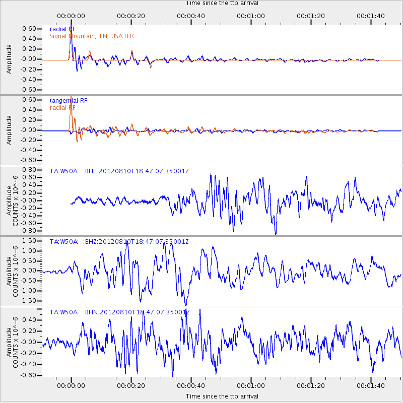
Earthquake location: Fox Islands, Aleutian Islands
Earthquake latitude/longitude: 52.6/-167.4
Earthquake time(UTC): 2012/08/10 (223) 18:37:43 GMT
Earthquake Depth: 13 km
Earthquake Magnitude: 5.9 MB, 6.2 MS, 6.2 MW, 6.2 MW
Earthquake Catalog/Contributor: WHDF/NEIC
Network: TA USArray Transportable Network (new EarthScope stations)
Station: W50A Signal Mountain, TN, USA
Lat/Lon: 35.20 N/85.31 W
Elevation: 587 m
Distance: 58.4 deg
Az: 72.189 deg
Baz: 314.882 deg
Ray Param: 0.06283971
Estimated Moho Depth: 49.0 km
Estimated Crust Vp/Vs: 1.77
Assumed Crust Vp: 6.35 km/s
Estimated Crust Vs: 3.583 km/s
Estimated Crust Poisson's Ratio: 0.27
Radial Match: 94.65972 %
Radial Bump: 400
Transverse Match: 78.55011 %
Transverse Bump: 400
SOD ConfigId: 469095
Insert Time: 2013-02-22 06:13:48.597 +0000
GWidth: 2.5
Max Bumps: 400
Tol: 0.001

Signal To Noise

ChannelStoNSTALTA
TA:W50A: :BHZ:20120810T18:47:07.35001Z7.288764.3840203E-76.0147684E-8
TA:W50A: :BHN:20120810T18:47:07.35001Z2.58106161.6267461E-76.302624E-8
TA:W50A: :BHE:20120810T18:47:07.35001Z2.99872831.5821983E-75.276231E-8
Arrivals
Ps6.3 SECOND
PpPs20 SECOND
PsPs/PpSs27 SECOND