W49A Belvidere, TN, USA - Earthquake Result Viewer
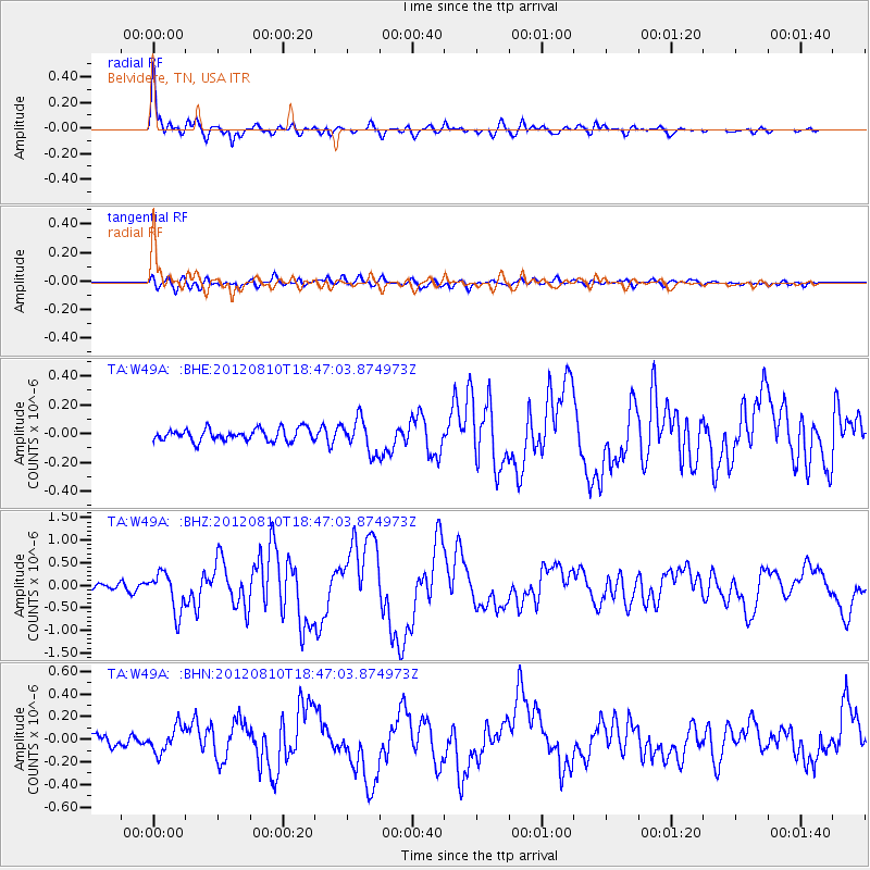
Earthquake location: Fox Islands, Aleutian Islands
Earthquake latitude/longitude: 52.6/-167.4
Earthquake time(UTC): 2012/08/10 (223) 18:37:43 GMT
Earthquake Depth: 13 km
Earthquake Magnitude: 5.9 MB, 6.2 MS, 6.2 MW, 6.2 MW
Earthquake Catalog/Contributor: WHDF/NEIC
Network: TA USArray Transportable Network (new EarthScope stations)
Station: W49A Belvidere, TN, USA
Lat/Lon: 35.12 N/86.26 W
Elevation: 251 m
Distance: 57.9 deg
Az: 72.904 deg
Baz: 314.713 deg
Ray Param: 0.06316371
Estimated Moho Depth: 25.75 km
Estimated Crust Vp/Vs: 1.61
Assumed Crust Vp: 6.476 km/s
Estimated Crust Vs: 4.029 km/s
Estimated Crust Poisson's Ratio: 0.18
Radial Match: 92.373665 %
Radial Bump: 400
Transverse Match: 61.85444 %
Transverse Bump: 400
SOD ConfigId: 469095
Insert Time: 2013-02-22 06:13:55.971 +0000
GWidth: 2.5
Max Bumps: 400
Tol: 0.001

Signal To Noise

ChannelStoNSTALTA
TA:W49A: :BHZ:20120810T18:47:03.874973Z5.74645474.3803237E-77.622654E-8
TA:W49A: :BHN:20120810T18:47:03.874973Z1.85540721.14412714E-76.166447E-8
TA:W49A: :BHE:20120810T18:47:03.874973Z2.73092461.151812E-74.217663E-8
Arrivals
Ps2.6 SECOND
PpPs9.8 SECOND
PsPs/PpSs12 SECOND